


|
||

|

|
|

|
Detailed chart of the coast of China from Staunton's An Authentic Account of an Embassy from the King of Great Britain to the Emperor of China, showing the tracks of the vessels carrying the Earl of Macartney's Embassy along the coast of China with a note of the dates as well as a series of depth soundings in fathoms.
The map includes the area around Hong Kong (unnamed) and Macao, part of Formosa and an extended look at the China coastline.
Staunton's work chronicles the Earl of Macartney's embassy to the Emperor of China. Macartney was dispatched to Beijing in 1792, traveling via Madeira, Tenerife, Rio de Janeiro, the Cape of Good Hope and Indonesia. He was accompanied by Staunton, and a retinue of suitably impressive size, including Staunton's 11-year-old son who was nominally the ambassador's page.
On the embassy's arrival in China it emerged that the 11-year-old was the only European member of the embassy able to speak Mandarin, and thus the only one able to converse with the Emperor. The embassy, the first such to China, had two objectives: the first to register with the Emperor, British displeasure at the treatment that the British merchants were receiving from the Chinese, the second to gain permission for a British minister to be resident in China. The first objective was achieved, the second was not. Macartney was twice granted an audience with the Emperor and in December 1793 he was sumptuously entertained by the Chinese viceroy in Canton, and returned to England via Macao and St. Helena, arriving in September 1794. This important work produced some of the earliest accurate maps of the interior of China and provided many invaluable geographical and cultural observations.
![[ Hong Kong, Canton & Environs ] Carte des Isles qui sont a L'Entree de la Riviere De Canton](https://storage.googleapis.com/raremaps/img/small/74493.jpg)
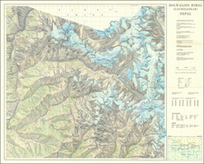
![[Map of Western Shangdong Province]](https://storage.googleapis.com/raremaps/img/small/60891.jpg)
![[Macau] Plan de la Ville et du Port de Macao](https://storage.googleapis.com/raremaps/img/small/74702.jpg)
![[ China ] L'Empire De La Chine dresse d'apres les Cartes de l'Atlas Chinois . . . 1751](https://storage.googleapis.com/raremaps/img/small/90831.jpg)