|
||

|

|
|

|
Antique Map of Miami, Florida Showing the Additional Unbuilt Venetian Isles.
Elegant map of the Greater Miami area,, with a note showing the beginning of Miami's street number grid system.
On the verso is a fine photographic view of the Miami Skyline looking East from the El Comodoro Hotel and the Dade County Courthouse under construction.
The lot across the street from the Dade County Court House (bottom left corner) is the current location of History Miami, home to the annual Miami International Map Fair.
Sauer and Seghy also created a smaller map showing the anticipated growth of Miami by 1935, entitled Map of the City of Miami and Environs Showing the Greater Miami Development and the Estimated Expansion for 1935, which is considerably more common than the present map.
Unbuilt Venetian Isles Additions
The map shows a string of islands stretching into the Intercoastal Waterway from Di Lido Island, comprising an unbuilt add-on to the original "Venetian Isles" development, which would have gone all the way to the present-day Indian Creek Country Club.
Interestingly, three of the islands have all of the proposed street names labeled as well.

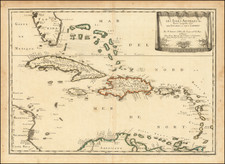
![[Florida Keys, Cuba, Bahamas, Cayman Islands] The Island of Cuba with part of the Bahama Banks & the Martyrs . . .](https://storage.googleapis.com/raremaps/img/small/85166.jpg)
![[Florida / Bahamas] . . . Mosquito Inslet to Key West. . . 1863](https://storage.googleapis.com/raremaps/img/small/75869.jpg)
![[ Practices of the Outina Warriors ] Outinae milites ut caesis hostibus utantur. XV.](https://storage.googleapis.com/raremaps/img/small/97802.jpg)