The item illustrated and described below is sold, but we
have another example in stock. To view the example which
is currently being offered for sale, click the
"View Details" button below.


|
||

|

|
|

|
Stock# 60858
Description
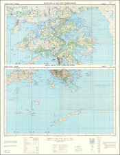
Detailed War Office and Air Ministry Two-Sheet Chart of Hong Kong.
Detailed British military mapping of Hong Kong, published in two sheets (here joined as one), in 1958.
The sheets are labeled first editions and have as their sources RAF Air Survey photography from November 1954, supplemented with ground survey revisions through August 1957. And, probably as the base map, the GSGS 3691 1:80,000 (1946) mapping of Hong Kong and the GSGS 3861 1:20,000 (1951-52) mapping.
As was the tradition at the time, the map's key differentiates between different kinds of roads, telegraph and telephone lines, villages, hamlets, etc., different land cover, and some bathymetric information.
Condition Description
Two sheets joined as one. Light toning in the upper right quadrant.
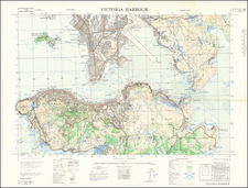
![[Hong Kong / Disneyland] Ngon Shun Chau (or Stonecutters Island) to Brothers Pt.](https://storage.googleapis.com/raremaps/img/small/55579.jpg)
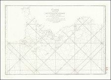
![[ Hong Kong, Canton & Environs ] Carte des Isles qui sont a L'Entree de la Riviere De Canton](https://storage.googleapis.com/raremaps/img/small/74493.jpg)
![[China] 古今地舆全圖 / Full Modern and Ancient Map](https://storage.googleapis.com/raremaps/img/small/62437kb.jpg)