


|
||

|

|
|

|
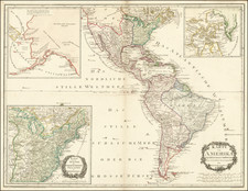
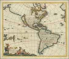
First state of Henry Schenk Tanner's map of America from his American Atlas.
The map shows Russian America (green) in great detail, with very little known or shown in California and the West.
The Lewis River reflects details supplied by Lewis & Clark in the Pacific Northwest. A massive Missouri Territory reflects the political subdivision which subsumed the Louisiana Purchase after the creation of the state of Louisiana.
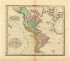
Tanner commenced production of his most ambitious project, his American Atlas, in 1818. Released in 5 folios between 1819 and 1823, the Atlas is widely regarded as the single most beautiful large scale American Atlas ever published. The maps are large, detailed and elegantly engraved. The production resulted in the split of Tanner from his partners Kearney & Vallance, but resulted in the greatest of American Atlases.