This item has been sold, but you can enter your email address to be notified if another example becomes available.


|
||

|

|
|

|
Stock# 59455
Description
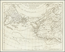
Nineteenth century reproduction of a rare hand drawn map of Quebec in 1660, between the St. Lawrence River and the Saint-Charles River.
The map contains a legend of 15 entries specifying the nature of the elements represented. The reproduction was made by Phileas Gagnon (archives of France).
The original map is in the archives of the French Foreign Ministry.
Condition Description
Ex Rochester Historical Society and ex-Rochester Public Library, with stamps, etc. on front and back. Pencil annotations.
![[The Final State] A New Map of North America, with the West India Islands, Divided according to the Preliminary Articles of Peace, Signed at Versailles, 20 Jan. 1783, wherein are Distinguished The United States and the Several Provinces, Governments &c Which Compose the British Dominions . . . 1794](https://storage.googleapis.com/raremaps/img/small/89085.jpg)