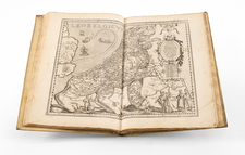
|
||

|

|
|

|
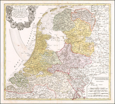
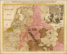
A beautifully detailed map of Utrecht, Veluwe, Zutphen, Holland, and Neder-Betuw published in Paris.
The map outlines in color the towns and municipalities of Utrecht, Veluwe, Zutphen, Neder-Betuwe, etc., and shows relief pictorially. Features lakes, forests, trees, mountains, waterways, and pathways throughout the region. The map also notes forts, windmills, dams, etc.
Includes an ornately engraved title cartouche, scale of miles and a compass rose.
Alexis-Hubert Jaillot (ca. 1632-1712) was one of the most important French cartographers of the seventeenth century. Jaillot traveled to Paris with his brother, Simon, in 1657, hoping to take advantage of Louis XIV's call to the artists and scientists of France to settle and work in Paris. Originally a sculptor, he married the daughter of Nicholas Berey, Jeanne Berey, in 1664, and went into partnership with Nicholas Sanson's sons. Beginning in 1669, he re-engraved and often enlarged many of Sanson's maps, filling in the gap left by the destruction of the Blaeu's printing establishment in 1672.