|
||

|

|
|

|
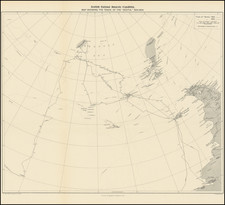
A Rermarkable Group of Manuscript Coast Charts
Intersesting group of finely executed coastal maps, drawn by an unknown author.
The group includes:
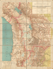
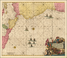
- Rade de Juan Fernandes (Chile) (10 x 16 inches)
- Rade de maldonado (Uruguay) (14 x 10 inches)
- Rade de guasco (Huasco, Chile) (11 x 13.5 inches)
- Port Valdivia (Chile) (9.5 x 13 inches)
- Baie de copiapo (Copiapo River, Chile) (10 x 13.5 inches)
- Rade de Coquimbo (Chile) (9 x 11.5 inches)
- Rade de Callao (Peru) (8.5 x 10 inches)
- Unidentified large Coastal Profile View (18.5 x 8.5 inches)
Annotated in French, the plans are the work of a skilled hand. Based upon the watermarks on the paper, we would date the maps to the last part of the 18th Century or the first part of the 19th Century. The coastal view is on slightly later laid paper, suggesting a date in the early 19th Century.
Understanding The Source
The watermarks on the paper suggests the paper is from the 1780s or 1790s. Several of the maps bear watermarks that are loosely attributable to the second half of the 18th century, but they do not show up in Bernstein (e.g., "FM"; cursive "M" in ornate shield). However, one of the sheets has a partial "J Kool" watermark, which shows up many times in the database and is attributable to the 1780s or '90s.
The charts would appear to be pre-Revolutionary Era (with regard to geography and place names of South America). They are mostly in French, although the Catalan word for waterfall (aiguade) is repeatedly used.
None of the priimary French voyages of discovery (Bougainville, La Perouse, de Surville, La Solide (second French circumnavigation), d'Entrecasteaux, Baudin, Freycinet, d'Urville) coasted the western coast of South America. Many of them put it at one or two ports, but they didn't follow the coast; nor did many visit Juan Fernandez. The one that did spend some time on the Chilean coast (or at least his men did), de Surville, did not go to all these ports. Even the Malaspina expedition on behalf of Spain did not visit each of these places. As such, it is more likely that the source is a well-trained merchant officer, who would have visited ports and noted houses and forts while sailing.
The maps include valuable observations, especially about fortifications, but are not as formal as the official sketches normally generated from a scientific expedition. Another possibility would be whaler.
The maps would seem to incorporate bathymetric information, which several Spanish expeditions undertook prior to independence. For example, Valdivia's map is very similar to the chart published by D. Lauriol circa 1821. The charts may derive from hydrographic works that were made by José de Moraleda y Montero, a Spanish Pilot and Mapmaker who created some of the most important observational data for this region in the last decades of the 18th Century. Moraleda led four expeditions between 1787 and 1796 from Callao to the Chiloe and Patagonian regions of Chile, which included extensive mapping and several important navigational diaries which covered this region. Some Spanish voyages carried French experts, so it is possible that this work derives from such an expert.
Provenance
The group was acquired as a set, reportedly coming from a larger album compiled by an early traveller. We cannot definitively connect the view with the 7 maps and they may in fact be from different hands or different parts of the world.