


|
||

|

|
|

|
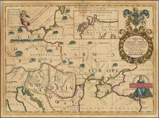
Rare separately published map of Poland, based on the work of Giovanni Antonio Rizzi-Zannoni, published in Vienna.
The map title is in French and German, and notes Poland is divided between its co-sharing partners.
The map includes significant battle related information, with annotations at the bottom right referencing a battle on August 3, 1775.
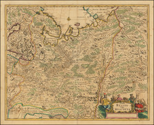
Another note references the prehistoric district of the Slobodan Elizbethgrad, which is no Kropyvnytskyi in Ukraine. The town has changed its name several times. In a letter of grant on January 11, 1752 to Major-General Jovan Horvat, the organizer of Nova Serbia settlements, the Empress Elizabeth of Russia ordered the Major-General "to found an earthen fortress and name it Fort St. Elizabeth". Thus simultaneously the future city was named in honor of its formal founder, the Russian empress, and also in honor of her heavenly patroness, St. Elizabeth.
The name Yelisavetgrad (usually spelled Elisavetgrad or Elizabethgrad in English language publications) is believed to have evolved as the amalgamation of the fortress name and the common Eastern Slavonic element "-grad" (Old/Church Slavonic "градъ", "a settlement encompassed by a wall"). Its first documented usage dates back to 1764, when Yelisavetgrad Province was organized together with the Yelisavetgrad Lancer Regiment.
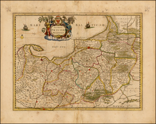
The map was issued at about the time of the Treaties of Tilsit wherein almost all that Prussia had gained by the partitions of Poland (1772-1795) was taken from it by France and its allies.
The Treaties of Tilsit were signed by Napoleon I of France in the town of Tilsit in July 1807, in the aftermath of his victory at Friedland. The first was signed on July 7, between Tsar Alexander I of Russia and Napoleon I of France, when they met on a raft in the middle of the Neman River. The second was signed with Prussia on July 9. The treaties were made at the expense of the Prussian king, who had already agreed to a truce on June 25 after the French Army had pursued him to the easternmost frontier of his realm. In Tilsit, he ceded about half of his pre-war territories. Napoleon created French sister republics, which were formalized and recognized at Tilsit: the Kingdom of Westphalia, the Duchy of Warsaw and the Free City of Danzig. The other ceded territories were awarded to existing French client states and to Russia.
The map shows the boundary between the French controlled Kingdom of Prussia and the Duchy of Warsaw, with the map extending from Drezdenko to Działdowo.
Following the Treaty, Napoleon would expand his territorial holdings to include all of Poland, with the Poles hoping to re-establish their Kingdom. However, after Napoleon's loss in Russia in 1812, the Duchy of Warsaw was retaken by Russia in January 1813, with the rest of Poland restored to Prussia.
![(Second World War - Holocaust) Hitlerowskie wiezienia i areszty na ziemiach Polskich w latach 1939-1945 | Hitlerowskie obozy pracy na ziemiach Polskich w latach 1939-1945 [Nazi prisons and arrests in Poland in 1939-1945 | Nazi labor camps in Poland in 1939-1945]](https://storage.googleapis.com/raremaps/img/small/82908.jpg)
![[ Poland / Lithuania / Kaliningrad ] Das Konigreich Preussenmit den freien Stadten Danzig u Thorn](https://storage.googleapis.com/raremaps/img/small/102639.jpg)