|
||

|

|
|

|
First State of Pieter Van Den Keere's Rare Map of America--The First Single Sheet Wall Map of America To Include Decorative Panels
"This very rare map is the first single sheet map of America with decorative borders" (Burden).
Van Den Keere's map of America is a cartographic landmark, being the first obtainable map of America to features decorative figures in the border. Inspired by Willem Janszoon Blaeu's 1608 wall map of America, Van Den Keere created a set of 4 maps of the continents which feature decorative figures of indigenous peoples at the sides and city veiws along the top and bottom. A unique variation employed by Van Den Keere, which was not incorporated by Blaeu, is the use of portaits of the most important American in the top and bottom borders, including Christopher Columbus, Amerigo Vespucci, Ferdinand Magellan, Francis Drake, Thomas Cavendish and Olivier Van Noort, identifying the accomplishments of each and the date of their epic voyage beneath the latter 4 names.
Cartographically, the map draws upon the work of Jodocus Hondius's 1606 map of America, which in turn was based upon a wall map by Petrus Plancius. It retains some of the most fascinating cartographic anomalies of the period, including the buldging east coast of Virginia and pronounced over-dramatic width of North America, extra wide South America, Straits of Anian, Quivira and narrow passage between South America and the Unknown Southern Continent.
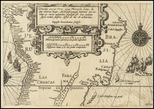
The present example is the first edition of the map, the only edition to show the Tierra del Fuego as an Island. Following the discovery by Le Maire and Schouten in 1616 of a more southerly passage from the Atlantic to the Pacific to the south of Tierra del Fuego, Van Den Keere modified the map in 1618, although the date remained unchanged.
The most important cartographic information in the map was the incorporation of Henry Hudson's discoveries in Hudson Bay, where "The B. wher Hudson did winter" is located, a very reference to Hudson's discoveries in 1614.
Van Den Keere fled to London in 1584 when he was 13 years old to avoid religious persecution. His sister married Jodocus Hondius, who was also then resident in London. With this introduction, Van Den Keere's career path was set. He returned to Amsterdam in 1593. The present map was engraved by Abraham Goos, Van den Keere's nephew.
The map is known in the following 6 states:
- 1614: Tierra del Fuego attached to the southern continent--1614 date.
- 1618: Tierra del Fuego is an island.
- 1631: Van Den Keere imprint replaced with Per Nicolaum Io. Visscher. Anno 1631.
- 1633: Date updated to 1633
- 1636: Date updated to 1636
- 1652: Staten Land is now and island at the tiop of South America and the date is updated to 1652.
The first state of the map is extremely rare on the market. Burden located only 3 known examples, none in American collections. We note only 1 appearance of the Van Den Keere states of map at auction or in a dealer catalog in the past 30+ years.
![(South Atlantic) Nieuwe Wassende Graadige Pas-kaart van de Kust van Guinea en Brasilia strekkende van Cap Verde tot de Cap de Bon-Esperance en Verders van Rio de Berbice tot Rio de la Plata. [New Increasing Latitude Sea Chart of the Coast of Guinea and Brazil stretching from Cape Verde to the Cape of Good Hope and Further from the Berbice River to the Rio de la Plata.]](https://storage.googleapis.com/raremaps/img/small/99819.jpg)
![Pascaart vertoonende de zeecusten van Chili, Peru, Hispania Nova, Nova Granada, en California…. [Early New Zealand Inset]](https://storage.googleapis.com/raremaps/img/small/65168.jpg)