
This item has been sold, but you can enter your email address to be notified if another example becomes available.


|
||

|

|
|

|
Stock# 5185
Description
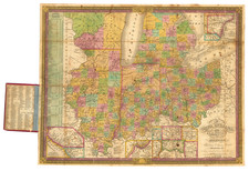
Scare and highly sought after map of Michigan, based upon David Burr's map of 1834, with corrections. Chipewa and Michilimackinac County appear in the Upper Peninsula, and the Township of Michillimacinac is present. The Ottawas & Miamies dominate the northern part of the state. The Boundary Line established by the Saginaw Treaty is shown, A number of Indian Villages are named. The map includes towns, early counties, roads, rivers, lakes, forts, and other notes. Gorgeous wash color. A wonderful example.


![[Run of 6 Volumes] Report Upon Geographical Surveys West of the 100th Meridian](https://storage.googleapis.com/raremaps/img/small/74064.jpg)
