|
||

|

|
|

|
Rare Proof State of Rene Phélipeau's Plan of Cap-Français
This is an extraordinary presentation copy of this previously unrecorded state of Rene Phelipeau's spectacular plan of Cap‑Français, offered here in glorious full original color. The present example, dated 1784, is a proof state, with significant differences from the final edition.
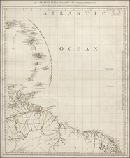
The plan is oriented with north at the top and provides a remarkably detailed plan of the city, fourteen years after its time as the capital of Haiti had come to an end. The hilly terrain surrounding the city is evident. The city is clearly an important commercial center, as can be seen from the orderly quay and warehouses to the west. The grid pattern of the city is stunningly precise; this is a planned city meant to trumpet French power and prestige abroad.
Certain features that would grace the final edition are lacking. Most notably, the proof state includes a blank dedication cartouche and pre-dates the inclusion of the soundings, four sailings ships, lettering off the coast (Baye Du Cap), and the description of the bridge at the bottom left (Elevation du Pont . . . ). Also, the directional arrow in the Riviere du Haut du Cap has not been included in the proof state.
Cap‑Français in the eighteenth century
Although initially colonized by the Spanish, the French took over the western third of the island of Hispaniola in the early-eighteenth century. As in the rest of the Caribbean, they developed large-scale plantations worked by enslaved Africans, with coffee plantations in the interior and sugar on the northern plains. The slave regime in Saint Dominque is considered by scholars as one of the most extreme. Slave mortality was high and violence common; the French imported over 800,000 men and women to the colony, practically double the total number imported to North America. This economic system built on the forced labor of thousands made Saint Domingue, as the French called the island, the most lucrative colony in the world.
Cap‑Français was the main commercial port of this burgeoning economy due to its location with easy access to the transatlantic trade. It was known as the "Paris of the Antilles." During this time the French built up the city, including the bridge over the Riviere Mapou profiled in the lower left corner. The city was also the political capital until 1770, when the capital designation moved to Port-au-Prince. As Malik W. Ghachem writes, "The meticulously ordered geometry and highly advanced development of the city attest to its political and economic significance in the French colonial order." Both the geometry and development of the city are highlighted in Phélipeau's bright plan.
The eighteenth century was the apex of Cap-Français, however. In 1789, just after this map was drafted, there were 170,000 people in the city; the majority of these were slaves. Today, the city has 190,000 people.
During the Haitian Revolution, the slave population, including those in Cap-Français, revolted. During the early years of the rebellion, Cap-Français was the site of many battles. In June 1793, the French governor of Saint Domingue, Thomas-François Galbaud, tried to raise a revolt of the whites against republican commissioners sent from France. To defeat him, the commissioners promised freedom to the slaves who would fight on their behalf. Thousands of whites fled Cap-Français, which nearly burned to the ground. This incident marked the end of white domination of the island and the beginning of slave emancipation.
Cap‑Français in the nineteenth century and beyond
Haiti won its independence in 1804, but the geopolitical tumult continued. Cap-Français was rebuilt and declared the capital of the Kingdom of Northern Haiti under the self-proclaimed King Henri Christophe during a time of civil war.
In the French and Indian War, on October 21, 1757, the French and British fought the Battle of Cap-Français just outside the harbor. The battle was hot yet indecisive; however, it is notable for the presence of a young Horatio Nelson. Nearly five decades later, on October 21, 1805, Nelson would lead the British in the Battle of Trafalgar.
Today, Cap-Français is known as Cap-Haïtian. It was again damaged in 1842, by a massive earthquake, and in 1928, by a hurricane. The port stills operates, though in a much reduced capacity when compared to its former glory. It was used as a relief port for other Haitian cities in 2010, after another earthquake devastated the south of the island.
The author and engraver
René Phélipeau was a French military engineer whose career followed the revolutions around the Atlantic. Trained as a surveyor, he was charged with surveying Saint-Domingue's major cities and towns in the 1780s, just before the outbreak of war. Prior to that assignment, he had served in Georgia during the American Revolution.
Phélipeau collaborated with the engraver Nicolas Ponce, which is why several of his Saint-Domingue maps appear in Recueil de vues des lieux principaux de la colonie françoise de Saint-Domingue, engraved by Ponce and printed in Paris, 1791, which was intended to accompany Description topographique, physique, civile, politique et historique de la partie française de l'isle Saint-Domingue, by Médéric Louis Elie Moreau de Saint-Méry, printed in two volumes in Philadelphia in 1797-1798.
C. J. Chaumier was a French engraver active in the second half of the eighteenth century. His surviving works include military maps and fine art engravings.
The present map would seem to be one of a set of at least 4 maps by Phelipeau, which includes:
Plan de la plaine du fond de l'Isle à Vache de l'Isle St Domingue: http://gallica.bnf.fr/ark:/12148/btv1b7003247x/f5.item.r=Phelipeau
Plan de la ville des Cayes, dans l'Isle Saint-Domingue: http://gallica.bnf.fr/ark:/12148/btv1b7200239x/f5.item.r=Phelipeau
Plan de la plaine du Cap François en l'Isle St. Domingue: https://www.loc.gov/item/73695940/
Each of the above have an identical added border and a similar decorative motiff at the bottom center of the border. The top motiff in each of the above 3 are identical, whereas the motiff on the Cap Francais offered here is different and a bit more elaborate. This is apparently the only proof state, as above are all dated 1786.
Rarity
This presentation copy appears to be unique. We note a 1784 example in the British Library, but the dimensions are smaller, suggesting it may be lacking the decorative border and may also be uncolored.
The map was finished and formally issued in 1785, without the decorative border and with the dedication cartouche and bridge in the bottom left completed: http://ufdc.ufl.edu/UF00028442/00001/1x
The single-sheet 1786 edition, which lacks the cartouche and bridge image and has a simpler compass rose, is held by several institutions including Harvard, the John Carter Brown Library, the Bibliotheque Nationale, and the Boston Public Library: http://ids.lib.harvard.edu/ids/view/28488283?buttons=y
A single-sheet version of the map was apparently issued in 1789: http://www.alienor.org/collections-des-musees/fiche-objet-29643-plan-de-ville-plan-de-la-ville-du-cap-francais-et-ses-environs-dans-l-isle-de-st-domingue
Curiously, one of the 4 sheets of this map also includes an uncolored section of the map printed on the verso: /gallery/enlarge/49958a
Malik W. Ghachem, with Susan Danforth, “The Other Revolution: Haiti, 1789-1804; II. The French Revolution and the Free People of Color (1789-1791),” item 6. http://www.brown.edu/Facilities/John_Carter_Brown_Library/exhibitions/haitian/pages/part2.html
1786 edition:
http://vc.lib.harvard.edu/vc/deliver/~maps/012839471
http://gallica.bnf.fr/ark:/12148/btv1b5972739g
http://www.leventhalmap.org/id/rb16883
http://jcb.lunaimaging.com/luna/servlet/detail/JCB~1~1~2357~3900004:Plan-de-la-Ville-du-Cap-Fran%C3%A7ois-et
![[ Sir Edmund Halley's Observations on the Variation of the Compass ] A New and Correct Chart of the Western and Southern Oceans Shewing the Variations of the Compass According to the latest and best Observations [with text:] The Description and Uses Of A New and Correct Sea-Chart of the Western and Southern Ocean, Shewing the Variation of the Compass](https://storage.googleapis.com/raremaps/img/small/98400.jpg)