
The item illustrated and described below is sold, but we
have another example in stock. To view the example which
is currently being offered for sale, click the
"View Details" button below.
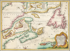
![A Plan of the City & Fortifications of Louisburg, from a Survey Made by Richard Gridley, Lieut. Col. of the Train of Artillery in 1745 [on sheet with] A Plan of the City and Harbour of Louisburg, with the French Batteries that Defended it . . . By Universal Magazine](https://storage.googleapis.com/raremaps/img/small/69378.jpg)


|
||

|

|
|

|
Stock# 48333

![Colton's Map of the United States The Canadas &c. Showing the Railroads, Canals, & Stage Roads With Distances From Place to Place…1856 [Pocket Map]](https://storage.googleapis.com/raremaps/img/small/85342.jpg)
![[Vancouver] Fraser River and Burrard Inlet](https://storage.googleapis.com/raremaps/img/small/68029.jpg)