This item has been sold, but you can enter your email address to be notified if another example becomes available.


|
||

|

|
|

|
Stock# 47820
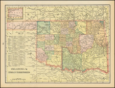
Description
Detailed map of a section of the Kansas-Indian Territory border, showing a section of the Cimarron River.
The primary man-made feature on the map is a ranch in what appears to be the general area of Lookout, Oklahoma.
Details on the map include
- South Boundary Line of the Osage Trust Lands
- 2 Saline Reservations
- Several Wagon Roads
- An unnamed Ranch and Pen on Anderson Creek
- A pen off Keener Creek
- Several circles at the end of Wagon Trails, reflecting an unknown symbol.
Condition Description
Drawn on tracing linen.


![[Geology Map of the Texas, California & the Southwest] Esquisse Geologique Des Anciennes Possessions Mexicains Du Nord Incorporees Ala Federation des Etats-Unis . . . 1867](https://storage.googleapis.com/raremaps/img/small/71446.jpg)

![[Original photograph] Native Americans, possibly Creeks, in outdoor camp with white settlers or Indian Agents.](https://storage.googleapis.com/raremaps/img/small/78740.jpg)