|
||

|

|
|

|
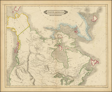
The First Dutch Sea Chart of New England and the Canadian Maritimes.
Rare Johannes Van Loon sea chart of the region from Narrangansett Bay and Cape Cod to Nova Scotia, Newfoundland and the Grand Banks. This important chart became the prototype of the region for the rest of the 17th century.
This rare chart appeared in Joannes and Giles van Loon's Klaer Lichtende Noort-Ster Ofte Zee-Atlas.
Van Loon's chart is an original composition, derived from sources including Guillaume Blaeu, Samuel de Champlain, and Hessel Gerritsz. The chart extends from Rhode Island to Newfoundland including Martha's Vineyard, Nantucket, and Prince Edward Island.
Van Loon chose not to show the English settlements in Newfoundland, particularly on the Avalon peninsula, even though that information was used by Blaeu. Prince Edward Island is noticeably missing and the Grand Banks are drawn from Champlain.
Joannes van Loon was an accomplished mathematician and astronomer. His earliest cartographic works were done in conjunction with Theunisz Jacobs in the 1640s. In the 1650s, Van Loon served as the engraver for Joannes Jansson and later engraved the plates for Andreas Cellarius' monumental celestial atlas of 1660.
This chart appears in 3 states:
- State 1: By Johannes en Gieles van Loon Plaet-snyder en Zee=caert-maker (Plate 34)
- State 2: By Johannes van Loon Plaet-snyder en Zee=caert-maker (Plate 34)
- State 3: By Johannes van Loon Plaet-snyder Inventor en Johan: Janssonius van Waesberge excud. (Plate 47)
The chart is very rare on the market. We locate no other examples listed on AMPR, although we are aware of an example offered by the Old Print Shop in the past 15 years.

![[ The Finest Colonial New England Sea Chart of the 18th Century ] The Coast of New England](https://storage.googleapis.com/raremaps/img/small/63672.jpg)