|
||

|

|
|

|
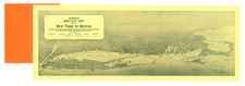
Rare separately issued map of the Central Part of the Boston Elevated Railway, published in Boston.
The map as issued shortly after the creation of this section of the line. An image of the verso, with a greater Boston map, can be found here: /gallery/enlarge/45590a
Boston Elevated Railway
The Boston Elevated Railway (BEy) was a precursor first to the Metropolitan Transit Authority in Massachusetts, now the Massachusetts Bay Transportation Authority, operating rapid transit, streetcars, and buses in the Boston area. It was formerly known as the West End Street Railway.
The West End Street Railway was founded in 1887. The first electric trolley line built by the West End Street Railway was between Union Square, Allston and Park Square, downtown, via Harvard Street, Beacon Street, Massachusetts Avenue and Boylston Street. Trolleys first ran in 1889. The Green Line "A" Branch later served roughly the same purpose.
The railway company constructed its own power stations; by 1897, these included distributed generation stations in downtown Boston, Allston, Cambridge (near Harvard), Dorchester, Charlestown, East Cambridge, and East Boston. By 1904, the system had 36 megawatts of generating capacity, 421 miles of track for over 1550 street cars (mostly closed but some open), and 16 miles of elevated track for 174 elevated cars.