This item has been sold, but you can enter your email address to be notified if another example becomes available.


|
||

|

|
|

|
Stock# 45351
Description
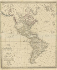
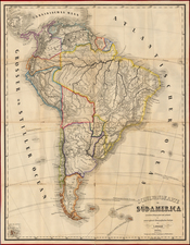
Detailed map of America, showing North America immediately prior to the discoveries of Lewis & Clark, and South America on the eve of its century of Revolution.
The map is dated 1816 and includes an unkown region west of the Rocky Moutains, pre-Humboldt configuration for the Rockies, limited knowledge of Louisiana Territory and NW Coast based upon Cook and Vancouver.
From Smith's General Atlas.
![Nov. Orbis sive America Septentrionalis . . [California as an Island]](https://storage.googleapis.com/raremaps/img/small/67439.jpg)