|
||

|

|
|

|
Unusual Eighteenth-Century Map of Solar Eclipses over Europe
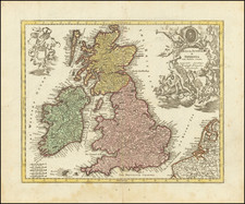
Rare, separately-issued map showing the solar eclipses of 1715, 1724, 1737, 1748 and 1764, including the famous 1715 Halley’s Eclipse, named for the pioneer of eclipse mapping, astronomer Edmond Halley.
This map, centered on London, shows the paths of total (1715, 1724) and partial (1737, 1748, 1764) solar eclipses that were visible from Europe. The extent of the map includes Ireland, England, Scotland, and parts of continental Europe including Germany and France. Each eclipse is labeled with its date and depicted as a shadowed path. The shadowed path design is visually impactful and a clear way to communicate how the moon passes in front of the sun.
The eighteenth century was the Golden Age of eclipse mapping, pioneered by Edmond Halley. Halley is renowned for predicting the path of the 1715 eclipse within twenty miles of accuracy and within four minutes of the time of totality. Halley was at the forefront of what would become widespread public fascination with eclipses and other astronomical events.
Astronomy as an accessible public science, something any person could observe by standing in the right place, continued to gain popularity. At the time, astronomical events were often conflated with astrological beliefs; eclipses were seen as equally exciting and ominous. Given the widespread public interest, major eclipses near a commercial hub such as London provided numerous business opportunities leading up to events.
The map was created in an azimuthal equidistant projection centered on London. Azimuthal maps show the world in 360 degrees radiating from a central point; they are particularly useful for mapping astronomical occurrences and polar regions. Gerard Mercator used this projection for his polar region inset maps on his famed 1569 world map, and it has been in wide use since the Renaissance for star charts and planispheres.
As a side note, dates on this map prior to 1750, when Great Britain changed to the Gregorian calendar, are recorded in the Julian calendar. Therefore, while Halley’s Eclipse is labeled April 22nd, 1715, modern viewers will be more familiar with the date of May 3, 1715.
This is the second edition of the map, which was first published by Robert Sayer in 1787. A note along the bottom margin indicates this example was published in London by Laurie and Whittle, employees of Robert Sayer, at No. 53 Fleet Street.
Robert Laurie (ca. 1755-1836) and James Whittle (1757-1818) formed their Fleet Street, London-based firm upon the 1794 death of their employer Robert Sayer, himself one of the dominant print and mapmakers of the last half of the 18th century.
Laurie & Whittle started managing Sayer's business as early as 1787. They took over all managerial duties when Sayer's health flagged in 1792, and they changed the imprint in 1794 upon his death. Sayer left the two a 21-year lease on the shop (at £100 a year) and on Sayer's Bolt Court premises, as well as an option to acquire stock and equipment at a preferential price of £5,000 payable over three years.
Robert Laurie retired from the firm in 1812, and his role was assumed by his son, Richard Holmes Laurie (1777-1858). The younger Laurie worked with James Whittle until the latter died in 1818. After R. H. Laurie died in 1858, Alexander George Findlay, FRGS (1812-1875) purchased the firm from his daughters. The firm continues today under another name, specializing in yachting charts.
Laurie & Whittle were prolific print and map publishers, and throughout their careers, they produced numerous very important and rare works. They carried on Robert Sayer's atlas business and were responsible for editions of The Complete East-India Pilot and The American Atlas.
![[ Southwest England ] Des Koenigreichs England sudlicher Theil oder Cornwall, Devon Shire, Dorset S. Somerset. S. Bristol, Wilt S. Hamp S. Berk. S. Buckingham S. undd Monmouth S.](https://storage.googleapis.com/raremaps/img/small/103898.jpg)
![[ Eastern Hemisphere Globe Gores. ] (Nova et integra universi Orbis descriptio)](https://storage.googleapis.com/raremaps/img/small/54480.jpg)
![[Spectacular Set of Wall Maps of the Continents Dedicated to King Charles II of England, &c.]](https://storage.googleapis.com/raremaps/img/small/93614.jpg)