|
||

|

|
|

|
One of the Earliest Geological Maps of the United States
Rare geological map of the United States, published in London, but utilizing a map originally engraved by Blondeau in London.
This map describes geological formations in color outline, rather than full color as employed by Maclure and other later geological maps.
Marcou comments that the map contains some geological additions for Texas and Canada, and a few other alterations, but otherwise is based entirely on Maclure's earlier map of 1809. The topographic base, prepared by P. Lapie, differs substantially from the earlier 1809 Maclure (Samuel Lewis) and 1811 Maclure (Volney) base maps encompassing the entire US including Louisiana territory. Watershed boundaries are carefully delineated by continuous topographic highlands.
This early map locates only two settlements west of the Mississippi: Santa Fe and Fort Mandan, site of the Lewis and Clark quarters during the winter of 1805-06.
The map originally appeared in Beaujour's Apercu des Etats-Unis, au Commencement du XIX, Siecle, depuis 1800 Jusqu' en 1810, published in Paris. Beaujour served as French consul general to the US from 1804 to 1814 and had an intimate understanding of US politics, transportation, and commerce.
The present example likely appeared in an English version of the book entitled Sketch of the United States of North America, was written primarily to encourage trade between the US and France, and included a summary of agriculture and geology supplemented by this map.

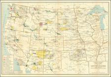
![[Shows Republic of Texas] United States and Texas](https://storage.googleapis.com/raremaps/img/small/101139.jpg)
![The Pathfinder Railway Guide Map. Western Section [Alaska, Yellowstone Park / Philippines / Hawaii / Guam]](https://storage.googleapis.com/raremaps/img/small/97894.jpg)