|
||

|

|
|

|
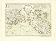
Fine example of Charles Smith's map of North America, issued shortly after the Louisiana Purchase. East of the Mississippi, a massive Western Territory is shown, predating Ohio, Indiana, Illinois and Michigan. East and West Florida are still shown. The course of the Missouri River is still not known beyond the Pawnee Villages, as the first report of Lewis & Clark would not be issued until the following year. A number of conjectural rivers reach from the Rockies to the Mississippi River, one suggesting potential portage to Pearl Shoal Lake, west of the Rockies (probably Salt Lake). The Columbia and Frasier Rivers appear in a highly speculative course. California is New California and New Albion also appears. Alaska is Russian Settlements. Most of the California missions are shown. An attractive early 19th Century map of North America.
![[Signed Political Satire Artwork] Vietnam ... Vietnam ... Vietnam ...](https://storage.googleapis.com/raremaps/img/small/68726.jpg)
![[ British Colonies in North America & Caribbean ] L'Amerique Angloise, ou Description des Isles et Terres du Roi d'Angleterre dans l'Amerique, Avec de nouvelles Carte de chaque Isle & Terres](https://storage.googleapis.com/raremaps/img/small/102812.jpg)