
This item has been sold, but you can enter your email address to be notified if another example becomes available.


|
||

|

|
|

|
Stock# 42410
Description
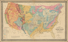
Interesting manuscript map of United States, drawn circa 1820.
The map includes Alabama Territory. Illinois Territory is pushed off Lake Michigan as was characterstic of maps published in this period.
East and West Florida are shown. East Florida existed as a Spanish province until 1822, although control was resolved by the Adams-Onis Treaty of 1819 (ratified in 1821), in which Florida became part of the United States.


![The Eagle Map of the United States Engraved For Rudiments of National Knowledge. 1833. [with:] Rudiments of National Knowledge, Presented To The Youth Of The United States, And To Enquiring Foreigners. By A Citizen Of Pennsylvania.](https://storage.googleapis.com/raremaps/img/small/86933.jpg)