


|
||

|

|
|

|
Fine early map of the Ancient World, published by Du Val in his Divers cartes et tables pour la Geographie ancienne, pour la chronologie et pour les itineraries et voyages modernes, first published in Paris in 1665.
The map is intended to show the world, as known in Ancient times. The depiction of Australia is based upon Marco Polo. The mythical island of Thule is shown.
Thule was a far-northern location in classical European literature and cartography. Though often considered to be an island in antiquity, modern interpretations of what was meant by Thule often identify it as Norway, an identification supported by modern calculations. Other interpretations include Orkney, Shetland, and Scandinavia.
In the Late Middle Ages and Renaissance, Thule was often identified as Iceland or Greenland. Another suggested location is Saaremaa in the Baltic Sea. The term ultima Thule in medieval geographies denotes any distant place located beyond the "borders of the known world".
The Greek explorer Pytheas is the first to have written of Thule, doing so in his now lost work, On the Ocean, after his travels between 330 BC and 320 BC. He supposedly was sent out by the Greek city of Massalia to see where their trade-goods were coming from.[7] Descriptions of some of his discoveries have survived in the works of later, often skeptical, authors. Polybius in his Histories (c. 140 BC), Book XXXIV, cites Pytheas as one "who has led many people into error by saying that he traversed the whole of Britain on foot, giving the island a circumference of forty thousand stadia, and telling us also about Thule, those regions in which there was no longer any proper land nor sea nor air, but a sort of mixture of all three of the consistency of a jellyfish in which one can neither walk nor sail, holding everything together, so to speak."
Strabo in his Geography (c. 30), Book I, Chapter 4, mentions Thule in describing Eratosthenes' calculation of "the breadth of the inhabited world" and notes that Pytheas says it "is a six days' sail north of Britain, and is near the frozen sea." But he then doubts this claim, writing that Pytheas has "been found, upon scrutiny, to be an arch falsifier, but the men who have seen Britain and Ierne (Ireland) do not mention Thule, though they speak of other islands, small ones, about Britain."
Strabo ultimately concludes, in Book IV, Chapter 5, "Concerning Thule, our historical information is still more uncertain, on account of its outside position; for Thule, of all the countries that are named, is set farthest north."
Nearly a half century later, in A.D. 77, Pliny the Elder published his Natural History in which he also cites Pytheas' claim (in Book II, Chapter 75) that Thule is a six-day sail north of Britain. Then, when discussing the islands around Britain in Book IV, Chapter 16, he writes: "The farthest of all, which are known and spoke of, is Thule; in which there be no nights at all, as we have declared, about mid-summer, namely when the Sun passes through the sign Cancer; and contrariwise no days in mid-winter: and each of these times they suppose, do last six months, all day, or all night." Finally, in refining the island's location, he places it along the most northerly parallel of those he describes, writing in Book VI, Chapter 34,: "Last of all is the Scythian parallel, from the Rhiphean hills into Thule: wherein (as we said) it is day and night continually by turns (for six months)."
The Roman geographer Pomponius Mela placed Thule north of Scythia. Other late classical writers and post-classical writers such as Orosius (384-420 A.D) and the Irish monk Dicuil (late 8th and early 9th century), describe Thule as being North and West of both Ireland and Britain. Dicuil described Thule as being beyond islands that seem to be the Faroes, strongly suggesting Iceland. In the writings of the historian Procopius, from the first half of the 6th century, Thule is a large island in the north inhabited by twenty-five tribes. It is believed that Procopius is really talking about a part of Scandinavia, since several tribes are easily identified, including the Geats (Gautoi) in present-day Sweden and the Saami (Scrithiphini). He also writes that when the Heruls returned, they passed the Varni and the Danes and then crossed the sea to Thule, where they settled beside the Geats.
Pierre Duval (1618-1683) was a French geographer, cartographer, and publisher who worked in Abbeville and Paris during the seventeenth century. He was born in the former city, in northeast France, before moving to Paris. Duval was the nephew of the famous cartographer Nicolas Sanson, from whom he learned the mapmaker's art and skills. Both men worked at the royal court, having followed the royal request for artists to relocate to Paris. In addition to numerous maps and atlases, Du Val's opus also includes geography texts. He held the title of geographe ordinaire du roi from 1650 and died in 1683, when his wife and daughters took over his business.
![[ Wright- Molyneux Map ] [ New mapp of the world according to Mr. Edward Wright commonly called Mercator's projection ]](https://storage.googleapis.com/raremaps/img/small/99967.jpg)
![[Early Photographic Facsimile of the 1529 Ribero World Map]](https://storage.googleapis.com/raremaps/img/small/67279.jpg)
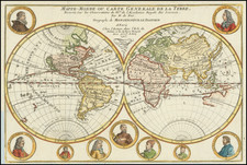
![[World Map with Portraits of Ferdinand Magellan, Willem Schouten, Francis Drake, Thomas Cavendish, Olivier van Noort and Joris van Speilbergen]](https://storage.googleapis.com/raremaps/img/small/90127.jpg)