


|
||

|

|
|

|
Nice example of perhaps the largest separately issued world map published in the 19th Century in the UK.
The map also reflects an attempt to add some manuscript details ln what appears to be explorations immediately to the North of Lake Victoria, which would not be discovered until reached by the British Explorer John Hanning Speke in 1858.
As noted by Rumsey:
With 48 inch spheres, this may be one of the largest World Maps produced in the early 1800's. Arrowsmith's Map of the World on a Globular Projection had 36 inch spheres and was last published in 1814. Gardner's map is fairly up to date in the American Northwest, less so in the plains area. He probably used Wyld's and Arrowsmith's maps of North America as sources. Not in Phillips or Wheat. British Museum World catalog lists this edition and an 1837 edition. The drawing and engraving of this map is very elegant and spare.
Cartographically, the map reflects the recent discoveries in Australia and New Zealand. The map provides an excellent template of Arctic explorations to date, showing the knowledge of the search for the Northwest Pasage at about the time of John Franklin's departure on his third Arctic Expedition in search of the Northwest Passage.
The map also reflects the earliest sighting and contact with the Antarctic, which occurred shortly before the map was published. The first land south of the parallel 60 o south latitude was discovered by the Englishman William Smith, who sighted Livingston Island on February 19,1819. A few months later Smith returned to explore the other islands of the South Shetlands archipelago, landed on King George Island, and claimed the new territories for Britain, each of which is located on the map.
The first confirmed sighting of mainland Antarctica cannot be accurately attributed to one single person. It can, however, be narrowed down to three individuals. According to various sources, three men all sighted the ice shelf or the continent within days or months of each other: Fabian Gottlieb von Bellingshausen, a captain in the Russian Imperial Navy; Edward Bransfield, a captain in the Royal Navy; and Nathaniel Palmer, an American sealer out of Stonington, Connecticut.
It is certain that the expedition, led by von Bellingshausen and Lazarev on the ships Vostok and Mirny, reached on January 28, 1820 a point within 32 km from Princess Martha Coast and recorded the sight of an ice shelf at 69 o 21'28"S 2 o 14'50"W that became known as the Fimbul ice shelf. On January 30, 1820, Bransfield sighted Trinity Peninsula, the northernmost point of the Antarctic mainland, while Palmer sighted the mainland in the area south of Trinity Peninsula in November 1820. Von Bellingshausen's expedition also discovered Peter I Island and Alexander I Island, the first islands to be discovered south of the circle.
Only slightly more than a year later, the first landing on the Antarctic mainland was arguably by the American Captain John Davis, a sealer, who claimed to have set foot there on February 7, 1821, though this is not accepted by all historians. In December 1821, Nathaniel Palmer, an American sealer looking for seal breeding grounds, sighted what is now known as the Antarctic Peninsula, located between 55 and 80 degrees west. In 1823, James Weddell, a British sealer, sailed into what is now known as the Weddell Sea.
The map is quite rare on the market. OCLC locates 1 copy of the 1825 edition (British Library). We note a varnished example at auction in 1998 at Christies.
![[ World & Continents ] Typus Orbis Terrarum / Americae Sive Novi Orbis Nova Descriptio / Asiae Nova Descriptio / Africae Tabula Nova / Europae](https://storage.googleapis.com/raremaps/img/small/99250.jpg)
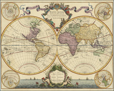
![[Eastern Hemisphere] Le Globe Terrestre Represente En Deux Plans-Hemispheres . . . 1740](https://storage.googleapis.com/raremaps/img/small/92751.jpg)
![[World Map / Malaria / Dr. Seuss ] This is Ann . . . She drinks blood!](https://storage.googleapis.com/raremaps/img/small/73499.jpg)
![(World) ЗАПАДНОЕ ПОЛУШАРИЕ | ВОСТОЧНОЕ ПОЛУШАРИЕ [Western Hemisphere | Eastern Hemisphere]](https://storage.googleapis.com/raremaps/img/small/90264.jpg)