The item illustrated and described below is sold, but we
have another example in stock. To view the example which
is currently being offered for sale, click the
"View Details" button below.
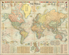
1908 G.W. Bacon & Co.
$ 1,400.00


|
||

|

|
|

|
Stock# 40298
Description
Decorative large format map of the world, showing the British Empire, at its height.
Around the map are inset details: with plans of towns including Hong Kong, Singapore, Sydney and New York; the Panama and Suez Canals; the British Isles; the two Poles; and a Universal Time Chart.
Along the top are a selection of national flags and ensigns; along the bottom are Gazetteers and a list of Principal British Steamship lines.
Condition Description
Dissected and laid on linen.
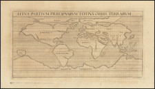
![[Pictorial World Map Gameboard]](https://storage.googleapis.com/raremaps/img/small/88775.jpg)
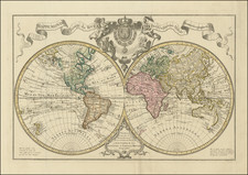
![Western Hemisphere. Eastern Hemisphere. [showin the Republic of Texas]](https://storage.googleapis.com/raremaps/img/small/82886.jpg)