This item has been sold, but you can enter your email address to be notified if another example becomes available.


|
||

|

|
|

|
Stock# 39952
Description
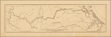
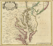
Scarce map of Virginia based largely on the Fry Jefferson map, as revised in 1775.
The map is one of the first large format maps of Virginia to have appeared in a British serial publication (Universal Magazine). It provides an excellent depiction of Virginia at the mid-point of the American Revolution.
Shows towns, counties, rivers, lakes, mountains, etc.
Condition Description
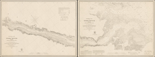
Minor soiling. Minor repaired tear at right margin, just entering printed image.
Reference
Jolly Univ-183.