


|
||

|

|
|

|
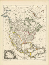
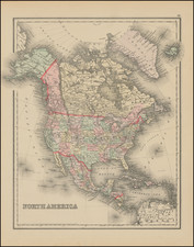
Excellent map of North America, being the first state of this map, issued immediately prior to the edition which is one of the earliest maps to show the details of Lewis & Clark's expedition and the earliest recorded map to show a river running from San Francisco to the Great Salt Lake (Teguayo), a myth which persisted for the next 20 years.
Malte Brun's maps, while modest in appearance, were meticulously researched and often included details of new discoveries far earlier than other map makers. This map is no exception. The map begins a sequence of several maps which depict, in fine detail, the early evolution of the American Northwest. A link to the 1812 edition can be found here: /gallery/detail/27025
Malte-Brun went to great lengths to insure that this fine little work reflected the best in contemporary cartographic detail.
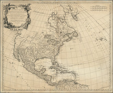
![A New Map of North America Shewing its Principal Divisions, Chief Cities, Townes, Rivers, Mountains &c. Dedicated to His Highness William Duke of Gloucester [California as an Island]](https://storage.googleapis.com/raremaps/img/small/100578.jpg)