This item has been sold, but you can enter your email address to be notified if another example becomes available.


|
||

|

|
|

|
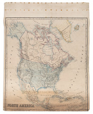
Stock# 38344
Description
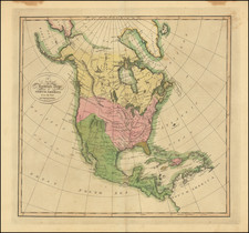
Detailed map of North America, immediately prior to the discoveries of Lewis & Clark.
The map is dated 1808 and includes an unknown region west of the Rocky Moutains, pre-Humboldt configuration for the Rockies, limited knowledge of Louisiana Territory and Northwest Coast based upon Cook and Vancouver.
California is New Albion and Upper California. Several rivers reach tentatively from the Mississippi to the Pacific Ocean but none with definite routes. Salt Lake is Pearl Shell Lake. The Missions of Upper California are noted.
The Upper Missouri reaches hopefully for a water route to the Pacific. Massive Western Territory is shown. A few contemporary pencil notes. Alaska is Russian Terrirtory.
From Smith's General Atlas.
Condition Description
Minor toning in margins from an old frame.
![[Fruit Crate Label Advertising Map] Panama Brand (North America & Panama Canal)](https://storage.googleapis.com/raremaps/img/small/48860.jpg)