This item has been sold, but you can enter your email address to be notified if another example becomes available.


|
||

|

|
|

|
Stock# 38157
Description
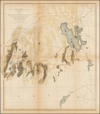
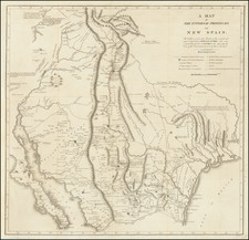
Striking five color map of Oklahoma divided in half (the 2nd half being Indian territory), issued by the United States Census Bureau, including illustrated text.
The Creek and Chickasaw Nations are divided into districts and the Choctaw Nation into early counties. Guthrie and Tulsa are now present.
Extraordinarily detailed. Extensive marginal notes, including a table of 13 railroads within the territory.
A fine copy of one of the great Oklahoma/Indian territory maps, with the original report.
Condition Description
69 pages of text. Map detached from text. Text is without covers.