


|
||

|

|
|

|
Rare large fomat sea chart of Florida, the Gulf Coast and the Caribbean, published in 1868 by James Imray.
The map provides an exceptionally detailed treatment of the Florida and Gulf Coasts, shortly after the conclusion of the American Civil War. Lighthouses are noted in color throughout.
The map retains the denotation of East and West Florida, although now nearly 40 years extinct.
The coastal detail, soundings and nautical features are exceptional, presenting the best obtainable surveys and details of the period.
James Imray was a publisher specialized in nautical charts. He started one of the most successful blue-back chart-selling companies of the nineteenth century; it is still in business today. Imray’s father was a dyer and he was born in Spitalfields, London, an area known for its garment industry. James did not want to enter the garment trade, however, and instead apprenticed to Stationer William Lukyn in 1818. Imray began his business as a book publisher and seller; however, he shared premises with Robert Blachford, a chartseller. Imray entered into business with Robert’s successor, Michael. He turned the business into a success and bought Blachford out in 1846, publishing under the imprint of James Imray. In 1854, son James Frederick joined as a partner and the imprint changed to Imray & Son. They thrived thanks to targeted marketing and excellent compilation charts that focused on trade routes. The busines entered in a long decline after the death of James Sr. in 1870. In 1899, Imray & Son amalgamated with Norie & Wilson. This conglomerate was bought by the Laurie firm in 1904 and today the business trades as Imray, Laurie, Norie & Wilson.
![[ St. Augustine, Florida ] Pagus Hispanorum in Florida](https://storage.googleapis.com/raremaps/img/small/82983.jpg)

![[Chiapas] Carta Postal de la Republica Mexicana Estado de Chiapas . . . 1934](https://storage.googleapis.com/raremaps/img/small/55436.jpg)
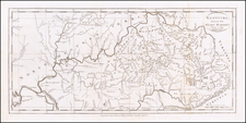
![[Hand Drawn Map] Le Golfe de Mexique avec les Pays Circonvoisins](https://storage.googleapis.com/raremaps/img/small/91580.jpg)
