|
||

|

|
|

|
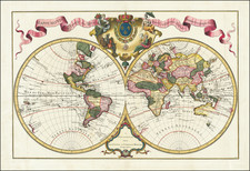
Laurie & Whittle’s Fine World Map—First State!
Scarce first state of Laurie & Whittle's two-sheet map of the world, showing the tracks of the recent British circumnavigations and filled with the latest details from European expeditions around the world.
The world map, on a Mercator projection, shows an empty Antarctic. The Arctic, by contrast, includes some tentative coastlines. Near a well-rendered Spitsbergen are two points—Purchass Point and “Gillis’s Land seen in 1707”—that are connected by a shadowy, hypothetical shore. Greenland is connected to Baffin Bay via land to the north, an interpretation of the ice that connected the landmasses.
Northern Greenland continues towards the west with a note, “Continuation of the Coast according to the Hypothesis of Green, Forster and several others.” This refers to the geographic work of John Green and Georg Forster. The former was a sharp-witted mapmaker and the latter the naturalist who accompanied James Cook on his second voyage.
In additions to sources including “a Japanese map” for the north coast of North America and the Russians for the far northeast of Asia, the map includes two northern voyages. The first, tracing the perimeter of Baffin’s Bay, is that of William Baffin in 1616. Along with Robert Bylot, Baffin searched for the Northwest Passage in 1615 and 1616. In 1615, they concluded that Hudson’s Bay was enclosed and did not lead to the Pacific. In 1616 they returned, circling Baffin’s Bay and deciding there was no outlet. It was not until Edward Parry sailed through Lancaster Sound two hundred years later that this information would be challenged.
The other ship’s track is that of the Racehorse to Spitsbergen. Commander Constantine Phipps, the second Baron Mulgrave, took the Racehorse and the Carcass north on the British Naval North Polar Expedition in 1773. They were thwarted by impenetrable ice just north of 80°N, as noted on this map.
Most of the inland areas on the map are studded with lakes and threaded with rivers and mountains ranges. In North America, the track of Alexander Mackenzie is shown. He is known for being the first person to accomplish an east-to-west crossing on North America north of Mexico in 1793, a year before this map was published. Here, his 1789 expedition is depicted. Working for the North West Company, Mackenzie followed rivers flowing northwest and indigenous reports. Although hoping to connect to the Pacific, he instead traced a river now named for him to the Arctic Ocean.
Australia, or New Holland, is shown as connected to Van Diemen’s Land; it would not be proven to be an island until Matthew Flinders and George Bass circumnavigated the island, now called Tasmania, in 1798-9. The west coast is riddled with the encounters of Dutch and English navigators, including William Dampier (with the erroneous year of 1688 included). The east coast is covered in British toponyms thanks to the first voyage of James Cook.
As explained in the title cartouche, this map features the tracks of a specific set of explorers: Byron, Wallis, Carteret, and Cook. After the close of the Seven Years’ War, Britain found itself with an expanded empire gained at the expense of France. They pushed this advantage into the Pacific, sending a series of voyages to probe the South Seas.
First out was Byron, who completed the fastest circumnavigation to date in 1764-6. Upon his return, his ship, HMS Dolphin, was turned around and sent out again, this time commanded by Samuel Wallis and accompanied by Philip Carteret, a veteran of the Byron expedition, in HMS Swallow. The ships were separated near Cape Horn, tracing separate tracks across the world’s largest ocean. Wallis and the Dolphin were the first Europeans to encounter Tahiti; they returned to England just in time to report this find to James Cook, who was fitting out to observe the Transit of Venus somewhere in the South Seas. All three of Cook’s voyages are included here.
Rarity
The first edition of this map is quite scarce. The later edition, which adds the track of La Perouse and a reference to La Perouse in the title, appears with greater frequency.
Cook's first voyage (1768-1771)
The Transit of Venus is one of the rarest predictable astronomical phenomena, occurring twice in eight years and then not again for over one hundred years (in a 243-year cycle). Observing the time it takes for Venus to transit across the sun can help to calculate the size of the solar system and the distance from the Earth to the Sun. In 1761, scientific societies sought to record the Transit from posts around the world. However, many of the observations were flawed or thwarted by the weather, especially those arranged, in haste, by the Royal Society of London. Determined to not repeat the same mistake, the Royal Society planned a South Sea voyage to view the 1769 Transit in concert with the Royal Navy, as the southern Pacific would be one of the places where the Transit was visible.
The Admiralty chose Lieutenant James Cook to command the expedition, based on his aptitude for charting and instrumentation. He was joined by Joseph Banks, a wealthy young botanist, and his retinue of scientists and artists. In addition to observing the Transit, Cook was secretly instructed to seek out and claim any potentially-useful territory or resources that his ship, Endeavour, came across.
Cook and his crew sailed from Plymouth on August 25, 1768. It sailed south, to Tierra del Fuego, and then to its destination for the Transit: Tahiti. There, three groups observed the Transit, although their results were imprecise. When the Endeavour left Tahiti in July 1769; on board was a new member of the party, the Rai’aitean priest and navigator Tupaia, along with his servant, Taiato.
The ship headed south, arriving in New Zealand in early October. There, Tupaia found that he could understand and speak with the local people, the Māori. However, this did not prevent several violent incidents that resulted in deaths. While charting the coastline, Cook and the voyage astronomer, Charles Green, observed the Transit of Mercury. The ship sailed round the southern tip of the South Island, proving it was not connected to a southern continent.
Next, the Endeavour set out east, encountering the east coast of Australia in April 1770. They were the first Europeans to do so. After stopping at a place they called Botany Bay, the ship turned north, skirting the coast. Endeavour ran aground on the Great Barrier Reef; while the ship was saved, they had to stop for repairs at Waalumbaal Birri, or Endeavour River. Here, the Europeans saw their first kangaroo and learned its name from the local people, the Guugu Yimithirr. They nearly ran aground again, but narrowly averted disaster and made for Jakarta, then known as Batavia.
In Batavia, many members of the crew became ill. More than two dozen men, including Sydney Parkinson, the voyage artist, the aforementioned Charles Green, and Tupaia, died in Jakarta or at sea soon thereafter. Weakened, the Endeavour called at the Cape of Good Hope and returned to the Thames in July 1771.
Cook's second voyage (1772-1775)
Cook’s first voyage was considered a success. The Admiralty chose to send him to the Pacific again, this time to focus on finding and charting Terra Australia incognita, if it existed. This time, Cook was in command of the Resolution and accompanied by the Adventure, captained by Tobias Furneaux.
The ships departed Plymouth on July 13, 1772. They made for the Cape of Good Hope and then sailed south, in search of land. They reached an ice sheet and could not find a break to sail through. The crew melted ice for fresh water and the expedition artist, William Hodges, drew eerie pictures of looming icebergs. On January 17, 1773, the ships crossed the Antarctic Circle, the first ships known to have done so.
Separated in fog, the ships headed toward New Zealand. They rendezvoused in Queen Charlotte Sound, where they traded with the Māori. The Māori inquired as to location of Tupaia and were sad to hear that he had died.
The ships returned to Tahiti, where they found the politics of the island had shifted and there was a new leader, Tu, to consult. Mai, a Rai’atean man, joined the Adventure, while Hitihiti joined the Resolution. The former became the first Polynesian to visit Britain, while Hitihiti returned home after sailing to Tonga, the Antarctic, New Zealand, and Easter Island.
Cook and his men next sailed to Tonga and then back to New Zealand. En route, the ships were separated again. Resolution left for southern waters without Adventure; Furneaux decided to return to Britain, leaving Cook in the Antarctic.
In December 1773 and January 1774, Resolution crossed the Antarctic Circle for the second and third times. They reached 71°10’ South, the farthest south any ships had sailed; the record would stand until 1823. He had decidedly proven that the great southern continent was nothing more than a myth.
Returning north, Cook called at Rapa Nui, or Easter Island, and his men marveled at the Moai, large statues that stand guard on the island. The Resolution returned to Tahiti, and then called at Niue, Nomuka, Vanuatu, New Caledonia, and Norfolk Island. After another visit to New Zealand, they sailed east to Tierra del Fuego. In the Atlantic, Cook named South Georgia and the South Sandwich Islands. On the homeward stretch, Resolution visited St. Helena and then anchored in Portsmouth on July 30, 1775.
Cook's third voyage (1776-1780)
After two Pacific cruises that observed the Transit of Venus, charted New Zealand, the eastern coast of Australia, and many islands; and disproved the existence of a vast southern continent, Cook’s third voyage focused on searching for the Northwest Passage. It was also tasked with the return of Mai, a Ra’iatean man and the first Polynesian visitor to Britain, who had joined Cook’s second voyage.
Cook in the Resolution was joined by Charles Clerke in the Discovery. Resolution sailed in July from Plymouth, rounded the Cape of Good Hope, visited the Kerguelen group in the Southern Indian Ocean, then called at Tasmania before heading to New Zealand.
In the spring of 1777, the ships sailed north, first to Tonga, and then to Tahiti. They left Mai on Huahine in a wooden house built for him by the crew. Cook continued north and became the first European to encounter the Hawaiian Islands, in January 1778.
During the warm months (in the northern hemisphere) of 1778, Cook and his crew charted the northwestern coast of North America, calling at Nootka Sound and Prince William Sound. They went up the Cook Inlet, which they thought could be a Northwest Passage, but it proved to be a false start. Heading west, they skirted the Aleutians and sighted the Asian coast. In January 1779, they returned to Hawai’i to resupply and rest.
In Kealakekua Bay, Cook was greeted warmly by the Hawaiians. They stayed for three weeks, enjoying the considerable hospitality of the people. In early February, the ships set out for another northern tour, but only a few days from Hawai’i the Resolution’s mast was damaged, forcing their return.
This time, they were not welcomed by crowds. During a dispute over a stolen boat, a scuffle broke out. When it was over, sixteen Hawaiians, four marines, and Cook were dead.
Clerke took command. He forced the Hawaiians to give him Cook’s remains, which were buried at sea. He then led the ships north, passing through the Bering Strait before turning back due to ice. In August of 1779, Clerke too died, of consumption, while near Kamchatka. A third commander, John Gore, then had to lead the ships home.
The ships sighted Japan on their southward journey before calling at Macao. There, they made sizeable profits by selling sea otter pelts, kickstarting a new industry. By April 1780, the Resolution and Discovery were back at the Cape of Good Hope. They returned to Britain via the Orkneys, anchoring in the Thames on October 7, 1780.
Robert Laurie (ca. 1755-1836) and James Whittle (1757-1818) formed their Fleet Street, London-based firm upon the 1794 death of their employer Robert Sayer, himself one of the dominant print and mapmakers of the last half of the 18th century.
Laurie & Whittle started managing Sayer's business as early as 1787. They took over all managerial duties when Sayer's health flagged in 1792, and they changed the imprint in 1794 upon his death. Sayer left the two a 21-year lease on the shop (at £100 a year) and on Sayer's Bolt Court premises, as well as an option to acquire stock and equipment at a preferential price of £5,000 payable over three years.
Robert Laurie retired from the firm in 1812, and his role was assumed by his son, Richard Holmes Laurie (1777-1858). The younger Laurie worked with James Whittle until the latter died in 1818. After R. H. Laurie died in 1858, Alexander George Findlay, FRGS (1812-1875) purchased the firm from his daughters. The firm continues today under another name, specializing in yachting charts.
Laurie & Whittle were prolific print and map publishers, and throughout their careers, they produced numerous very important and rare works. They carried on Robert Sayer's atlas business and were responsible for editions of The Complete East-India Pilot and The American Atlas.
![[World] Dated Events War Map . . .](https://storage.googleapis.com/raremaps/img/small/88833.jpg)
![Eastern Hemisphere [with] Western Hemisphere](https://storage.googleapis.com/raremaps/img/small/98321.jpg)