This item has been sold, but you can enter your email address to be notified if another example becomes available.


|
||

|

|
|

|
Stock# 31037
Description
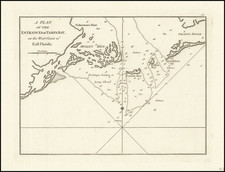
Nice example of Blunt's blue backed sea chart of the Southern Coastlines of the United States, from Texas to Florida, along with a highly detailed treatment of Cuba and the Bahamas, first published in 1845 and revised on a nearly annual basis for at least the next 15 years.
The chart includes 10 inset maps and harbor plans, including the harbors of Puerto Rico, St. Thomas, Rum Key, St. Martin's Harbor, Turks Island Anchorage, Havanna, Matanzan, Ragged Islands, Mayaguez, and Tampico.
Originally drawn when Texas was still a Republic. Includes numerous soundings and compass roses.
Blue backed sea charts were intended for use at sea and very rarely survive in such nice condition.
Condition Description
Blue backed sea chart. Minor discoloration.
![Carte Des Antilles Du Golfe Du Mexique et d'une partie des Etats voisons…1842 [Republic of Texas]](https://storage.googleapis.com/raremaps/img/small/98848.jpg)
![[ Oil & Gas in Texas and Louisiana ] Gulf Coastal Region Texas and Louisiana Showing Oil, Gas & Sulphur Fields & Prospects Pipe Lines & Refineries](https://storage.googleapis.com/raremaps/img/small/101409.jpg)