
This item has been sold, but you can enter your email address to be notified if another example becomes available.


|
||

|

|
|

|
Stock# 30350
Description
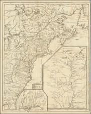
Rare separately issued map of the northern part of Mississippi and Alabama, produced by Lindenkohl and lithographed by Krebs at the direction of the US War Department in 1864.
One of the most detailed maps of the region produced during the war.
During the Civil War, the US Coast Survey Department became the official mapmaking branch of the United States War Department. Under the direction of A.D. Bache, many of the most talented surveyors and mapmakers were employed compiling maps from existing official and commercial sources. Among the most active were the Lindenkohl brothers, whose names appear on a number of these compiled maps.
Condition Description
Some minor soiling and a few areas of loss at fold intersections, most notably bottom center. Old fold splits, supported on the verso with archival tape.


![[ French Louisiana ] Carte De la Louisiane par Le Sr. D'Anville Dressee en Mai 1732. Publiee en 1752](https://storage.googleapis.com/raremaps/img/small/88804.jpg)
![(Southern Travel Journal) [Manuscript travel journal to Mobile, Alabama by Andrew Clark, Jr. of Methuen, Massachusetts, also by horseback through Kentucky and Tennessee and up the Mississippi north to Pittsburgh]](https://storage.googleapis.com/raremaps/img/small/93034.jpg)
