|
||

|

|
|

|
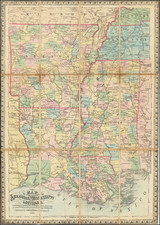
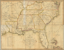
Scarce map of the Southern Part of Alabama Territory, which along with the map of the Northern District of Alabama Territory are the first printed maps of any portion of Alabama Territory following its formation.
While attributed to Gardiner, Gardiner at most served as the compiler of information supplied from local surveyors. The surveys referenced in the title were conducted under the direction of Thomas Freeman, depictom the results of the first official Government Survey in the recently created Alabama Territory.
Alabama became a Territory on August 15, 1817. The map is the earliest printed map of any region within the newly formed Alabama Territory and, along with a companion map of the Northern District of Alabama Territory, served as the primary source for John Melish's Map of Alabama, published October 29, 1818.
The map tracks the course of the Alabama River and the Georgia Road, with the only settlements apearing on the map being St. Tephens and Fourt Claiborne in the south. The township surveys shown are among the earliest surveys to apply the surveying
The cartographic history of the creation of Alabama Territory begins with formation of Mississippi Territory. Thomas Freeman was appointed Surveyor General of the Mississippi Territory by President Thomas Jefferson to survey the newly ceded lands found within the newly formed Madison County in the Mississippi Territory. Freeman had been the primary US Surveyor in the region since 1806, following the completion of the Red River Expedition (also known as the Freeman-Custis Expedition), one of the first civilian scientific expeditions to explore the Southwestern United States.
Freeman arrived in the Tennessee Valley in September 1807. He then met with leaders of the Cherokee and Chickasaw Nations at the Chickasaw Island (today known as Hobbs Island). Using astronomical observations, Freeman established these boundaries. Freeman surveyed each boundary up to the 35th parallel, he then proceeded to mark a point for the commencement for the Huntsville Meridian.
After this point was defined, Freeman and his crews proceeded to run the Huntsville Meridian back to the Tennessee River. The base line seemingly split the new triangular-shaped Madison County in half. Freeman later extended the Huntsville Meridian more than 100 miles further south until it reached what became known as the "Freeman Line". This separating both the northern and the southern survey districts of the Mississippi Territory. Freeman completed the surveying of more than 345,000 acres of land within Madison County.
One of the major bench marks that Freeman relied upon while surveying the Southern District was the Ellicott Stone. Andrew Ellicott established this point to the north of the Mobile Bay area when he was commissioned by George Washington to represent the United States during the Pinckney Treaty with Spain. This treaty called for the survey of an international boundary between the two countries. The Ellicott Stone marked a point along this boundary as it was surveyed along the 31st parallel. Later, the St. Stephens Meridian was run north of this same point until it reached the Freeman Line. Similar to the Huntsville Meridian, townships were laid out with ranges running east and west of the base line.
Between 1812 and 1821, the population increased by 142% in what is now Alabama. During this era General Jackson had waged such effective war against the Indians in the Mississippi Territory that their war strength was effectively destroyed. Treaties were signed with all of the principal tribes of Indians and definite boundary lines were agreed upon. Thus all of the Indians were confined to definite and very restricted areas, this freeing large areas for settlement by whites. After these treaties, there remained only to established the boundary lines agreed upon, and to survey the land in preparation for sale.
in October 1815, as a step towards opening the new lands for settlement, President Madison, upon Jackson's recommendation, appointed John Coffee, Jackson's long time friend, business partner and Indian Fighting partner, as one of the three American commissioners to ascertain and survey the new Indian boundary established by the Treaty of Fort Jackson. Coffee immediately proceeded to Fort Strother to meet the other commissioners. He waited more than a week and when still they did not appear, he began running an experimental line by himself. He ran the line northwesterly towards Fort Deposit, from which point it was to follow down the Tennessee River to the Chickasaw lands. While Coffee had been waiting at Fort Strother, the other commissioners, meanwhile, had met at Fort Mitchell but had been prevented from joining him because of illness.
Although Coffee's survey had been approved, the War Department questioned its validity because he had proceeded alone. The Cherokee Indians also protested that Coffee's survey claimed parts of their lands as having been included in the Creek Cession. Their claims were confirmed by the War Department. In July 1815, he received instructions to join one of the other commissioners to survey the line specified in the Cherokee agreement.
The commissioners soon discovered that both the Chickasaws and the Choctaws were claiming part of the land that had been awarded to the Cherokees, and consequently the planned survey had to be abandoned. After a conference held at the Chickasaw council house in September 1815, and as a consequence of the treaties that followed, the commissioners obtained relinquishment of all the Indian claims to lands within the area of the Creek Cession, and Coffee returned to complete the boundary survey.
Before the commissioners had completed the marking of the boundary line in January 1817, the government was receiving increasing pressure from land speculators and prospective settlers to open these lands as soon as possible. The lands had to be surveyed before they could be made available for sale.
John Gardiner was the chief clerk of the General Land Office during the War of 1812. Among the more noteworthy events attributed to Gardiner was his removal of the General Land Office records from Washington by carriage, during the siege by the British. His name appears on several early maps, including a Map of the Bounty Lands in Illinois Territory, a map of the military boundary lands in Arkansas Territory, a similar map of Alabama Territory and the present map.
While the map of the bounty lands in Illinois Territory appears occasionally on the market, the remaining maps are extremely rare. This is perhaps due to Congress's refusal to publish the map and provide copies to militarty veterans. As noted below, Gardiner's request that copies of the map of Missouri Territory be provided to veterans was considered and rejected by Congress.
The Debates and Proceedings in the Congress of the United States at page 39 notes that on Monday, December 7, 1818:
The President communicated a letter from John Gardiner, presenting to the Senate maps of the Alabama Territory and of the military bounty lands in the Missouri Territory. . . " Similarly at page 346, it is noted that "The Speaker laid before the House a letter from John Gardiner, enclosing a map of Alabama and of military bounty lands in Missouri, and stating that if Congress thinks proper to give to each soldier a map with his bounty land, he is willing to relinquish his impression on reasonable terms. . . "