|
||

|

|
|

|
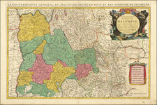
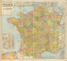
Detailed early map of Bretagne.
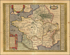
Henricus Hondius (1597-1651) was a Dutch engraver and mapmaker, a member of a prominent cartographic family. His father, Jodocus Hondius, was also an engraver and geographer. While working with his father, Henricus was instrumental in the expansion and republishing of Mercator’s atlas, first published in 1595 and republished by Hondius in 1606.
Upon his father’s death in 1612, Henricus and his brother, Jodocus the Younger, took over the business. He set up his own shop in 1621, where he continued to release new editions of the Mercator atlas. Later, he partnered with his brother-in-law, Jan Janssonius, in continuing to expand and publish Mercator’s atlas, which would become known as the Mercator-Hondius-Janssonius atlas. Born and based in Amsterdam, he died there in 1651.
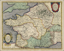
Melchior Tavernier was a member of a large family involved in the publishing trade in Paris in the early years of the seventeenth century. Early in his career, he apparently collaborated with Henricus Hondius, as at least one of his early maps references Tavernier as the seller of a map engraved in Amsterdam, by Hondius. He is probably best known for his publication of a map of the Post Roads of France, which was copied many times until the end of the century. He also issued an atlas under the same title as J. le Clerc's Theatre Geographique, using many of Le Clerc's maps, but incorporating others from different sources. He published composite atlases and also published works for other cartographers, including N. Sanson, N. Tassin, and P. Bertius. He is not to be confused with his nephew of the same name (1594-1665), who also engraved maps for Nicolas Sanson.
![[Modern France] Gallia Nova Tabula](https://storage.googleapis.com/raremaps/img/small/60252.jpg)