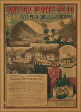
|
||

|

|
|

|
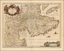
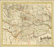
Striking regional map of Northwestern Italy, from the Lake Districts and the Coast of Liguria to Mantua and Modean, centered on Milan and Lago di Como.
Includes 2 striking cartouches. Shows roads, rivers, mountains, lakes and many other details.
Carel (Carol) Allard (Allardt) (1648–1709) was an engraver and publisher based in Amsterdam. Part of a prominent family of Dutch mapmakers, publishers, and print sellers, his father was engraver and publisher Hugo Allard (1627–1684), who left his business to Carel upon his death. Carel published anything in demand, including maps, topography, ethnography, newsprints, and restrikes of old plates of artistic prints, many of which likely came from his father’s stock. In 1706, Carel gave his copperplates to his son Abraham Allard, before going bankrupt.