


|
||

|

|
|

|
Very rare separately issued sea chart, published by Charles Wilson, successor to J.W. Norie.
A rare privately printed, separately issued sea chart of Hawaii, including an inset of the Harbor of Honolulu and Karakakoa Bay, along with inset maps of San Diego, San Francisco and the Coast of California. The map bears the name of H. Clarkson & Co., of London, one of London's leading shipping companies and was probably used aboard one of its ships in the mid-19th Century. Founded in London in 1852, the company is still one of the largest shipping companies in the world.
The reference to Honoruru or Fair Haven is the oldest known name for Honolulu. The first European vessel to enter Honolulu Harbor was HMS Butterworth in 1794, a British ship commanded by Captain William Brown. Sailors aboard the ship dubbed the harbor Brown's Harbor. Captain Brown insisted that the harbor be called Fair Haven. Fair Haven is translated into the Hawaiian language as Honolulu.
While the map is undated, there are several clues as to its date. Union Town appears near Humboldt Bay. The town name was changed to Arcata in 1860. The map identifies the Point Loma Lighthouse, which opened in November 1855. A "proposed lighthouse" is shown at Pt. Fermin on the California Coastline. The lighthouse was proposed in 1854 and construction completed in 1874. The Table Bluff lighthouse near Humboldt Bay (established 1856) is shown.
The chart is undated, but bears the address of the Navigation Warehouse and Naval Academy, from which Norie and Wilson from 1815 to 1880. Norie retired in 1830.
The chart is very rare, with no examples listed in OCLC and no examples
John William Norie (1772 – 1843) was a publisher of nautical books held in high regard by his contemporaries. He also specialized in nautical charts and was a mathematician. Norie was born in Wapping, London, the eldest of eight children.
Norie had an apptitude for navigation and chart making. His first work was published in 1796, The Description and Use of Hadley's Quadrant, by William Heather, a chart and instrument seller. Heather then took Norie on as a chart maker and allowed him to run a nautical academy out of Heather's premises on Leadenhall Street. He continued to work for Heather, working out of his shop.
Norie published many works, but the most famous were A Complete Set of Nautical Tables (1803) and the Epitome of Practical Navigation (1805). Both were reissued throughout the nineteenth century, usually together. The Tables are still issued today. The Epitome became the standard work on navigation; it was so famous that authors C. S. Forester and Jack London both mention the book in their fiction. In addition to the Epitome, Norie wrote the The shipwright's vade-mecum (1822), Plates Descriptive of the Maritime Flags of All Nations (1838), and The naval gazetteer, biographer, and chronologist; new and improved (1842). He also provided pilots with charts that covered practically the entire world's seas--the famous blue-back charts.
Norie partnered with a financial backer, George Wilson, to buy Heather's business upon Heather's death in 1813. In addition to the nautical academy and the copyright to his books, Norie prospered from the growing business, which he managed. The shop, operating under the sign of the Wooden Midshipman, was called the Navigation Warehouse. It featured in Charles Dickens' Dombey and Son.
Norie retired in 1840. He sold his shares in the business and moved to Edinburgh. He died there, at the age of 71, on Christmas Eve 1843. His company was renamed Norie & Wilson after his retirement. In 1903, the firm merged with rivals and became Imray, Laurie, Norie & Wilson. It is still in business today.
![California and Nevada [Yosemite, Sacramento, and San Francisco Insets]](https://storage.googleapis.com/raremaps/img/small/79443.jpg)
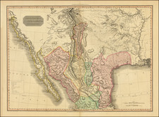
![[Austins Colony] Mexico & Guatemala](https://storage.googleapis.com/raremaps/img/small/94054.jpg)
![[ Chinese Voyages To America, etc. ] Memoires De Litterature, Tires Des Registres De L'Academie Royale Des Inscriptions et Belles-Lettres Depuis l' annee M. DCC. XVIII. julques & compris l'annee M. DCC. XXV Tome Quarante-Neuvieme](https://storage.googleapis.com/raremaps/img/small/101296.jpg)