|
||

|

|
|

|
Second state of Seller's important early English chart of the Atlantic and the contiguous coasts of North America, the Caribbean, Europe, the Mediterranean and Africa, identifying his many partners of the period, after the first edition of 1675.
This general chart of the Atlantic Ocean from Seller's Atlas Maritimus is one of Seller's most famous and influential charts, elegantly embellished with an elephant cartouche dominating the interior of Africa. This feature inspired Jonathan Swift's quatrain criticizing the ignorance of map-makers: "So Geographers in Afric-maps, With Savage-Pictures fill their Gaps; And o'er unhabitable Downs, Place Elephants for want of Towns." This second edition of the map includes the names of Seller's recently added partners. The partnership was created to save Seller from financial difficulties.
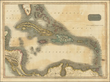
The chart finds is origins in Willem Jansz. Blaeu's second West Indische PASKAERT, published circa.1630, the first sea chart relating to America to use Mercator's projection. The coverage here does not extend as far westward and excludes the Gulf of Mexico, an area of little or no English activity or interest at the time. For his cartouche Seller draws upon the Blaeu version published by Jacob Aertsz. Colom, c.1655. Here though he is generous to the elephant, giving him a less onerous 'tower' to bear. Teh map retains the portolano style employed by Blaeu, with relatively little detail in the interior.
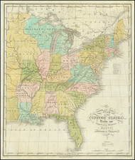
Seller's treatment of Tierra del Fuego is more up-to-date, with new geographocal is inserted around the La Plata River. The region between Chesapeake Bay and Long Island in North America is improved, an area that the early Dutch cartographers had long had difficulty with. Florida bears the standard early nomenclature of both the Spanish and French. Further north the toponyms are completely English. All of the English colonies are named including New Iarsey and placenames in Carolina.
A near fine example of the map, which rarely appears on the market.
John Seller was one of the most notable map and instrument makers in England in the late-seventeenth century. He was especially known for the sea charts, many of which featured in his influential English Pilot and Atlas Maritimus. Seller was born in London in 1632. His father was a cordwainer and John was apprenticed to Edward Lowe, of the Merchant Taylors’ Company. He was made free of that company in 1654. Later, he also was made a brother of the Clockmakers’ Company, which housed several instrument makers. He started business as a compass maker but expanded his offering to include navigational instruments and charts.
Seller’s career was halted temporarily, and fantastically, when he was tried for high treason in 1662. He was accused of involvement in a plot led by Thomas Tonge. While Seller likely only unwisely repeated rumors, he was convicted. The other conspirators, who did admit some degree of guilt, were executed, but Seller maintained his innocence and, via insistent petitions, he eventually secured his release from Newgate Prison.
This episode did not seem to slow Seller’s rise too much, however. Seller was granted a royal license to publish English-language maritime atlases. This gave him a near-monopoly and led to his being named hydrographer to the King in 1671. Although the point of the project was to produce English charts of Dutch dominance and bias, Seller ended up using many Dutch plates as his base material. The first volume of The English Pilot was published in 1671, followed by more volumes as well as The Coating Pilot (1672) and the Atlas Maritimus (1675). Seller was commercially successful, but some of his projects required further support. The English Pilot was eventually taken over by John Thornton and William Fisher, for example, and his proposed English atlas only produced maps of six counties.
Seller’s sons, John and Jeremiah, followed in their father’s profession. Seller also apprenticed several promising young men, including Charles Price, with whom his sons partnered. Through Price, Seller can be seen as the founding figure of an important group of London mapmakers that included Price, John Senex, Emanuel Bowen, Thomas Kitchin, and Thomas Jefferys.
![(Second World War - Eastern Front) [Strikes by the Red Army on the Enemy in 1944] Удары Красной Армии По Противнику в 1944г.](https://storage.googleapis.com/raremaps/img/small/68414.jpg)