The item illustrated and described below is sold, but we
have another example in stock. To view the example which
is currently being offered for sale, click the
"View Details" button below.
1795 Mathew Carey
$ 475.00


|
||

|

|
|

|
Stock# 22039
Description
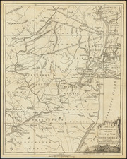
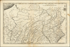
Nice example of the first state of Carey's map of Pennsylvania, from Carey's American Atlas, the first atlas of America printed in the United States.
This map includes the Erie triangle north of the 42nd parallel though evidence of an earlier erasure along the 42nd parallel suggests that the map was originally engraved by J.T. Scott (see Wheat & Brun 438).