The item illustrated and described below is sold, but we
have another example in stock. To view the example which
is currently being offered for sale, click the
"View Details" button below.


|
||

|

|
|

|
Stock# 21231
Description
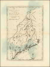
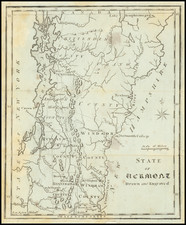
One of the earliest American maps of Vermont, from the first American gazetteer.
Joseph T. Scott, a Philadelphia engraver and publisher, issued his gazetteer during the early days of American cartography. Scott included much detail of rivers, counties, roads, and towns. This map of Vermont includes precise detail of settlements and roads, including "Govr. Chittenden"s home in the north. Also shown is Dartmouth College, just across the Connecticut River, which is not shown on the map of New Hampshire.
Condition Description
Minor foxing and offsetting
Reference
Wheat & Brun 196.