
This item has been sold, but you can enter your email address to be notified if another example becomes available.


|
||

|

|
|

|
Stock# 20120
Description
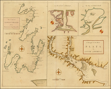
Rare map early edition of Gussefeld's map of South Florida, the Caribbean and coastlines of Central America.
The map would be updated and re-issed for at least the next 20 years, with corrections. A comparison of this edition to the 1816 edition which we previously posted shows that this edition illustrates the flow of the Gulf Stream, but with fewer directional arrows than the later edition. There is also an annotation below Hispaniola on this edition discussing the split control of the island, which is not present in the later editions. For a link to the 1816 edition, click here: /gallery/detail/16411
![La Florida [with] Guastecan [with] Peruviae Auriferae Regionis Typus](https://storage.googleapis.com/raremaps/img/small/84003.jpg)
![Carte Des Antilles Du Golfe Du Mexique et d'une partie des Etats voisons…1842 [Republic of Texas]](https://storage.googleapis.com/raremaps/img/small/98848.jpg)
![Amer. Sep. No. 69. Porto-Rico [and the Virgin Islands]](https://storage.googleapis.com/raremaps/img/small/42102.jpg)