This item has been sold, but you can enter your email address to be notified if another example becomes available.


|
||

|

|
|

|
Stock# 1744
Description
Interesting early map of New Mexico and Arizona, extending from the confluence of the Colorado and Gila Ries to Nicollet River in the northwest, the Rio Pecos in the Southwest and Bent's Fort, the Arkansas, Cimmaron and Canadian Rivers in the Northwest. The focus of the surveys is along the Rio Grande in the Santa Fe and Taos area. Many Indian Tribes named, including the Apaches Tontos, Coytero Apaches, Garotero Apaches, Copper Mine Appaches, White Mt. Meszcalero and Sacremento Apaches, Jicarillo apaches, Moquis, Navajoes, Arapahoes, Cheyennes and Kiowas.
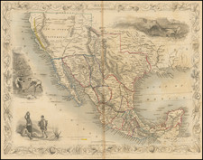
![Central Route to the Pacific, From The Valley of the Mississippi To California. Journal of The Expedition of E.F. Beale, Superintendant of Indian Affairs In California, And Gwinn Harris Heap, From Missouri To California [with map:] Map of the Central Route from the Valley of the Mississippi to California](https://storage.googleapis.com/raremaps/img/small/99222.jpg)