


|
||

|

|
|

|
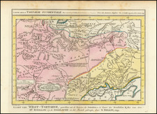
Extremely separately issued 18th Century map of Russia, by an unknown mapmaker. The British Library catalogue suggests that the map was printed in Vienna, while the Harvard Catalogue suggests Petropoli.
From Lithuania and Poland in the west to the Pacific Ocean and the Aleutian Islands in the east, the Russian Empire sprawls across this map with great detail and refinement. Though the cartographer is unknown, he left the mark of his skill in this informative, skillfully crafted document.
Where the boundaries of Russia leave open space at the lower corners and upper center portions of the map, beautifully engraved cartouche and vignettes add elegance. At the top, a classically draped woman and putti display the title of the map, engraved in block letters on a scroll. In the lower left corner, a pyramidal arrangements of coats-of-arms showcase Russia's largest cities, including Smolensk and Riga. At the lower right, another white-robed woman reclines as she passes Russia's flag to Mercury, who stands ready to spread its glory abroad.
With its expansive size and fine detail, this is a map to be perused at length. Its fine binding and exceptional aesthetics indicate that it was intended for an educated, well-to-do consumer in the 18th Century.
![[Stop The Fake News!] Halte au Menteurs! Les Colo Bacilles Sement La Haine!](https://storage.googleapis.com/raremaps/img/small/59951.jpg)