The item illustrated and described below is sold, but we
have another example in stock. To view the example which
is currently being offered for sale, click the
"View Details" button below.


|
||

|

|
|

|
Stock# 15464
Description
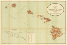
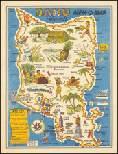
Detailed large format map of the Hawaiian Islands, showing counties, towns, bays, points, mountain, rivers, elevations, Volcanoes, volcano houses, halfway houses and Lava flows from various eruptions (somed dated) and other details. Includes a table of distances in nautical miles to various major ports of the Pacific Ocean. A nice decorative example.
![[Kilauea Volcano] The Crater on the Summit of Mount Worroray, Owhyhee](https://storage.googleapis.com/raremaps/img/small/91698.jpg)