The item illustrated and described below is sold, but we
have another example in stock. To view the example which
is currently being offered for sale, click the
"View Details" button below.


|
||

|

|
|

|
Stock# 14925
Description
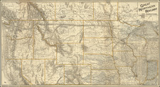
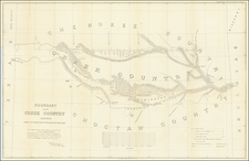
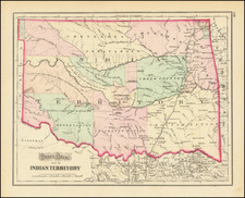
Detailed map of Indian Territory, hand colored by Indian Reservation. Shows villages, forts, rivers, and a number of notes regarding the dates various regions were ceded to the United States by the respective tribes. One of the earliest separate maps of Indian Territory to appear in a commercial atlas.
O.W. Gray Biography
O. W. Gray was a publishing firm based in Philadelphia. Later, they published as O. W. Gray & Son. They published atlases in the late nineteenth century. Gray's National Atlas was one of the most successful commercial ventures of the 1870s and one of the last to employ hand coloring on maps.