


|
||

|

|
|

|
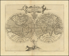
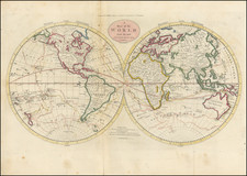
Double hemisphere map of the world reduced from Rumold Mercator's map of 1587.
A figure of Atlas supports the spheres from below. The map follows Plancius' globe of 1592 in many respects. Includes a massive southern continent, narrow passage between NW Coast of America and NE Coast of Asia. Narrow strait separates the unknown Southern Continent from South America, pre-dating the discoveries of Le Maire and reflecting only Magellan's information.
Beach appears near Australia, one of several bits of information derived from Marco Polo. Quivira and Anian are named on the West Coast of North America and the Rio Colorado and Rio Grande are both shown flowing into the Gulf of California. Florida and Norimbega are the only place names on the Eastern Coast of North America.
Cornelius de Wytfliet (ca.1550-ca. 1597) was a Flemish cartographer most famous for his Descriptionis Ptolemaicae Augmentum. The work was published in Louvain, Belgium, and had nineteen maps of the Americas.
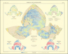

![(World) Des Mers On appelle mer cette vaste etendue… [Of the seas: We call sea the vast expanse of water that covers the larger portion of the earth. . .]](https://storage.googleapis.com/raremaps/img/small/91418.jpg)