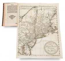
|
||

|

|
|

|
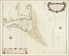
A beautiful map of Northeastern Canada, including Nova Scotia, Labrador and Newfoundland.
The map's vertical format elongates the geography and distorting Newfoundland. The St. Lawrence River runs nearly north-south.
The map is very detailed, especially along the coastlines and rivers. Many place names, both European and Indian. At bottom right is a scene with several sailing ships. At top left is a huge decorative title cartouche featuring allegorical figures, Indian chiefs, explorers, mapmakers, a fleet of ships, fishermen and wildlife.
Tobias Conrad Lotter (1717-1777) is one of the best-known German mapmakers of the eighteenth century. He engraved many of the maps published by Matthaus Seutter, to whose daughter Lotter was married. He took over Seutter’s business in 1756. Lotter’s son, M. A. Lotter, succeeded his father in the business.

![Colton's Map of the United States The Canadas &c. Showing the Railroads, Canals, & Stage Roads With Distances From Place to Place…1856 [Pocket Map]](https://storage.googleapis.com/raremaps/img/small/85342.jpg)