
This item has been sold, but you can enter your email address to be notified if another example becomes available.


|
||

|

|
|

|
Stock# 13432
Description
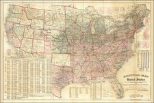
Interesting map of the United States, which includes several geo-political borders which existed for only a short period of time, including Mississippi Territory before the creation of Alabama, and a massive Indiana, which includes all of Illinois. The region west of the Mississippi is still Louisiana Territory, with no subdivisions yet added. The topographical detail of the map is extraordinary, as its its depiction of early Indian Tribes, forts, mountain ranges and rivers. East and West Florida are also still shown.

![(Puzzle Map) Mapa de America Del Norte y Central Razas y Fauna Del Continente [Map of North and Central America Races and Animals of the Continent]](https://storage.googleapis.com/raremaps/img/small/91115.jpg)
![Vereinigte Staaten Von Nordamerika [United States of North America]](https://storage.googleapis.com/raremaps/img/small/92015.jpg)
![[Unusual Italian Immigrant Communities shown!] America Settentrionale, Centrale e Meridionale -- Carta Dimostrativa Delle Ambasciate, Legazioni, Consolati (Con Le Risettive Circoscrizioni Territoriali), Camere Di Commercio, Agenzie Commerciali, Stazion Enotecniche, Uffici Postali, Ospedali, Scuole Governative e Sussidiate All'Estero](https://storage.googleapis.com/raremaps/img/small/86098.jpg)