This item has been sold, but you can enter your email address to be notified if another example becomes available.


|
||

|

|
|

|
Stock# 13229
Description
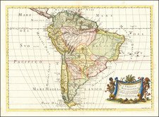
Detailed map of America, showing showing North America immediately prior to the discoveries of Lewis & Clark and South America on the eve of its century of Revolution. The map is dated 1808 and includes an unkown region west of the Rocky Moutains, pre-Humboldt configuation for the Rockies, limited knowledge of Louisiana Territory and NW Coast based upon Cook and Vancouver. Attractive and detailed. From Smith's General Atlas.
![[Nova et Acurata Totius Americae Tabula auct. G.I. Blaeu] America quarta pars orbis quam plerunq, novum orbem appellitant) primo detccta est anno 1492, a Christophoro Columbo Genuensi auspicijs Regis Castiliae, Deutde ulterius perucistigata navigationibus Americi Florentini, de cuius nomine America dicta est circiter annum 1497 Verum anno 1520 Ferdiandus Magallanus primus fuit qui extremos limites ad austru vergentes navigatione per fretum de nomine suo Magallanicu dictu uisitauit et noto fecit](https://storage.googleapis.com/raremaps/img/small/81465.jpg)
![L'Amerique Autrement Le Nouveau Monde et Indes Occidentales . . . 1664 [First Complete State]](https://storage.googleapis.com/raremaps/img/small/99731.jpg)