|
||

|

|
|

|
This map offers a detailed depiction of the Rhine River from its source to its mouth, featuring two elaborate cartouches. The map highlights significant geographical and political features of the Rhine and its surrounding regions during the early 18th century, particularly emphasizing the events of the War of the Spanish Succession (1701-1714).
The central focus of the map is the Rhine River, shown winding through key territories such as Alsace, Lorraine, and the Palatinate. Major cities along the Rhine, including Cologne (Köln), Mainz, Strasbourg (Straßburg), and Bonn, are prominently marked. The river's tributaries, the Moselle (Mosel) and the Main, are also depicted, providing a comprehensive view of the region's waterways.
The upper right cartouche, adorned with classical motifs and figures, details the military achievements of Joseph I, Holy Roman Emperor, celebrating the capture of the fortified city of Landau on September 10, 1702. This victory was a significant event during the War of the Spanish Succession, where Allied forces sought to prevent the unification of the Spanish and French crowns under the Bourbon dynasty.
The lower left cartouche features an inset map detailing the sources of the Rhine River, emphasizing the river's importance and the precise delineation of territorial boundaries. Surrounding this inset are allegorical figures representing the river gods of the Rhine and the Moselle, symbolizing the rivers' significance in the region's geography and commerce.
The map's intricate details and artistic elements not only provide a geographical representation but also serve as a historical record of the political and military context of the early 18th century. The depiction of Landau under siege, with troops and fortifications visible, offers a visual narrative of the warfare tactics and the strategic importance of the city.
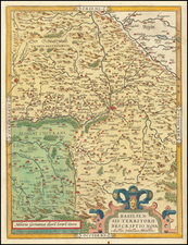
Johann Baptist Homann (1663-1724) was a mapmaker who founded the famous Homann Heirs publishing company. He lived his entire life in Bavaria, particularly in Nuremberg. Initially, Johann trained to become a priest before converting to Protestantism and working as a notary.
In 1702, Johann founded a publishing house that specialized in engravings. The firm flourished, becoming the leading map publisher in Germany and an important entity in the European map market. In 1715, Johann was named Imperial Geographer to the Holy Roman Empire by Charles VI and made a member of the Prussian Academy of Sciences. Most importantly for his business, his reputation and contacts gained him imperial printing privileges which protected his publications and recommended him to customers. Johann is best known for this Grosser Atlas ueber die ganze Welt, or the Grand Atlas of the World, published in 1716.
After Johann died in 1724, the business passed to his son, Christoph (1703-1730). Upon Christoph’s early death, the company passed to subsequent heirs, with the name of the company changing to Homann Erben, or Homann Heirs. The firm continued in business until 1848.
![Atlas Novus Reipublicae Helveticae XX. Mappis . . . [with] Schweitzer-Geographie. Samt den Merkwurdigkeiten in den Alpen und hohen Bergen. Zur Erläuterung der hommannischen Charten herausgegeben](https://storage.googleapis.com/raremaps/img/small/84155.jpg)
![[ Gravelines ] Grauelinge attacato dalle Armi Francesi sotto il Maresciallo della Ferte Seneterra alli 16 di Agosto 1658, reso alli 28 dello stesso mese](https://storage.googleapis.com/raremaps/img/small/102594.jpg)
![[ Augsburg ] Augusta iuxta figuram quam his ce temporibus habet delineata](https://storage.googleapis.com/raremaps/img/small/54872mp2.jpg)