|
||

|

|
|

|
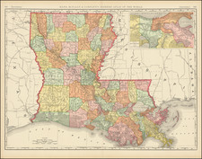
This rare separately published "Map of the Sixth District and Carrollton Compiled From Actual Surveys and the Best Authorities by Wm. H. Williams," provides a detailed representation of the Sixth District of New Orleans and the area of Carrollton.
The map was lithographed by L. Manouvrier & D. Simon in New Orleans.
The map includes a chart of routes and distances, references to notable landmarks, explanations of property divisions, and a list of former or alternate street names alongside their new names. The detailed mapping of streets, squares, and key infrastructure highlights the meticulous planning and urban development of the area during this period.
The map was created by William H. Williams, who was a prominent New Orleans surveyor and created other rare and important maps of the region, including this Plan of the City of Jefferson, Louisiana (later annexed by New Orleans) in 1861.
Historical Context and Significance
The Sixth District of New Orleans: The Sixth District of New Orleans encompasses areas that have historically been central to the city's development. This district includes significant neighborhoods such as the Irish Channel, Garden District, and parts of Uptown New Orleans. Originally part of the city's expansion plans, these areas were incorporated into New Orleans in the early 19th century as the city grew beyond its original boundaries along the Mississippi River. The Sixth District's development was influenced by the influx of Irish and German immigrants in the mid-19th century, leading to diverse cultural and architectural contributions.
Carrollton: Carrollton, initially an independent municipality, was founded in the early 19th century and officially incorporated in 1845. It was named after Charles Carroll of Carrollton, the last surviving signer of the Declaration of Independence. The town developed as a suburban retreat for New Orleans residents, featuring large lots and wide streets, which contrasted with the denser urban core of New Orleans. Carrollton’s incorporation into New Orleans came in 1874, shortly after this map was created, marking a significant expansion of the city's boundaries.
The area was notable for its unique position along the Mississippi River and its role as a transportation hub, facilitated by the New Orleans and Carrollton Railroad, one of the earliest streetcar lines in the United States. This transportation link helped integrate Carrollton more closely with New Orleans, promoting residential growth and commercial activity.
Landmarks and Infrastructure
The map provides references to key landmarks and infrastructure within the Sixth District and Carrollton. Some notable entries include:
- Custom House & Post Office: Central to the administrative functions of the district.
- Jackson Square: A historic park and gathering space, central to New Orleans' cultural heritage.
- Charity Hospital: A critical institution providing medical care to the city's residents.
- Various Markets: Such as the French Market and Jefferson Market, which were vital for commerce and daily life.
These landmarks indicate the mixed-use nature of the area, combining residential, commercial, and civic spaces.
Urban Development and Changes
The explanations section of the map highlights the adherence to original property divisions and the renaming of streets, reflecting the evolving urban landscape. The preservation of faubourg (suburban) names alongside new municipal designations provides an excellent transition between historical continuity with (then) modern locations.
By 1900, the Sixth District and Carrollton had fully integrated into New Orleans' urban fabric. The development of streetcar lines further spurred suburbanization, with Carrollton becoming a desirable residential area due to its accessibility and relative tranquility compared to the bustling city center. This period also saw significant architectural developments, with the construction of ornate homes and public buildings that remain characteristic of the area today.
Rarity
The map is rare on the market and not listed in OCLC, RBH or AMPR.
We note 1 example offered at auction (RBH lists the same example offered in 2013 and 2017).
Civil engineer and surveyor William H. Williams (1817-1886) was a prominent figure in the New Orleans area.
“Williams was born in Cincinnati, Ohio, in 1817, and was the son of Jacob Williams, who was a merchant. He was educated in Ohio, and in 1848 he immigrated to New Orleans, where he was subsequently married. He was a civil engineer and followed his profession up to the time of his death in 1886. He was prominently identified officially with the city of Carrollton, which was at that time an independent municipality. He was surveyor of the city and held other prominent positions after coming to New Orleans. For a number of years he was connected with the levee board of the city, and was engineer on the great delta survey of the Mississippi river. Williams was president of the Carrollton school board for seventeen years. In politics he was democratic. His wife, whose maiden name was Lavinia Pollard, was the daughter of Charles Pollard of Virginia. His sons, W.C. Williams and C. Milo Williams owned the firm, W. C. Williams & Brother, architects, New Orleans, Louisiana.” (LAC Group, Finding Aid to the William H. and C. Milo Williams notebooks, 1853-1894 at Tulane University Special Collections)
Tulane holds well over one hundred of Williams’ survey notebooks, including seven from 1860 alone, and it is likely that close examination of those would shed much light on this plan of Jefferson.