|
||

|

|
|

|
The First Wall Map of Fort Worth, Texas
Rare wall map of Fort Worth, Texas, drawn by Beach Nichols and published in Fort Worth by Goodfellow & Williams, Civil Engineers & Surveyors.
The map illustrates Fort Worth in the year after the Panic of 1893 and following a period of significant growth, when the city had grown from 6,663 (1880) to 23,076 (1890). While this is not the earliest map of Fort Worth, it is by far the largest 19th Century printed map of Fort Worth which were able to locate and also the only map of the period to capture the full extent of Fort Worth's growth, as the only similar maps are much earlier and fail to capture the explosive growth of Fort Worth in the 1880s (1880s King Map of the city of Fort Worth and vicinity) or do not actually show all of Fort Worth and it suburbs (1890 O'Brian & Rudiger Map of Fort Worth Texas).
The city is divided into Nine Wards, with numerous subdvisions outside of the City Line Corporate Limits identified by name, with Arlington Heights shown on the west side of the Clear Fork of the Trinity River. Outside of the city limits, the names of larger landowners and "surveys" appear, along with the occasional Farm House and named residence, barn, gravel pit, and artesian well.
Immediately east of the city center, the site of Robert E. Maddox's Maddoxia Park Farm is shown, including a Trotting Park, Palace Stables and Exercise Park.
The primary embellishment to the map is a large birdseye view of the Texas Brewing Company.
The map includes an extensive directory of local businesses, from Architects and Attorneys to a Wine Manufacturer and Water Dealer, the latter being of note as the map was printed just two years after Fort Worth had approved a major upgrade in its City Wells, drilling an additional 9 wells at an estimated cost of $600,000.
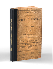
The map includes advertising for Ye Arlington Inn, the Chicago, Rock Island & Teas Railway and the "Texas Pan Handle Route" of the Ft. Worth and Denver City Railway. This is also the earliest "Directory" map of Fort Worth, as the few printed directories published prior to 1900 did not include maps.
Early Fort Worth Maps & Views
We note the following early maps and views of Fort Worth, with the present map by Beach Nichols being more than 3 times larger than any of the below listed maps.
- 1880s King, Map of the city of Fort Worth and vicinity.
- 1885 Gray's New Map of Fort Worth, Texas
- 1886 Wellege, Fort Worth, Tex.,"The Queen of the Prairies" . . .
- 1890 O'Brian & Rudiger Map of Fort Worth Texas
- 1891 Wellege, Perspective map of Fort Worth, Tex.
- 1885-1898 Sanborn Fire Insurance Maps
- 1888-1899? Rand McNally Map of Fort Worth Texas
Robert E. Maddox
Robert E. Maddox was a prominent figure in 19th-century Fort Worth, playing a vital role in various sectors. Born to Colonel William A. and Mary Mays Maddox on a Louisiana plantation, Maddox initially pursued a career in the mercantile industry. He later moved to Fort Worth in 1873, where he served as a city tax assessor-collector and engaged in multiple business ventures, notably in real estate, livestock, and utilities.
Maddox's entry into Fort Worth’s entrepreneurial scene began with clerking at S. P. Tucker’s grocery store, followed by his election as city tax assessor-collector in 1876, a position he held into the 1880s. During this period, he also served as president of the Middleton Tate Johnson Hook and Ladder Company. His real estate ventures took off in 1881, allowing him to eventually indulge in his passion for livestock trading, especially horses.
By the late 1880s, Maddox had established himself as a successful real estate dealer, notably investing in the Daggett addition and founding Maddoxia Park stock farm, which housed his Grand Palace Stables. This farm not only served as his residence but also reflected his dedication to livestock breeding, particularly horses. Additionally, Maddox's horse, Luke Short, notably competed in a race at the colored state fair.
Beyond real estate and livestock, Maddox diversified his investments, co-founding Fort Worth Light and Power Company in 1885 and playing a key role in the city's stockyards-packing plant complex. His involvement in the Fort Worth Union Stock Yards Company and Fort Worth Dressed Meat and Packing Company contributed significantly to the city's economic growth. Maddox Avenue is named for Robert E. Maddox.
Texas Brewing Company
The Texas Brewing Company was established in 1890 by Jesse Shelton Zane-Cetti and three partners in Fort Worth. Located on Jones Street between 9th and 11th streets, it was set in the lively area of Hell’s Half Acre.
Built on nearly five acres, the brewery was self-sufficient, producing its own water and electricity. It also operated its own barrel-making workshop and had private railroad tracks and cars for logistics. During its early years, Texas Brewing Company quickly became a significant local employer and industrial presence in Fort Worth. It was one of the city's first major industries before the establishment of the stockyards and packing plants.
The brewery started brewing beer by 1891 and participated actively in community events, such as the German celebration of Maifest, further embedding itself in local traditions and culture. By 1907, it was among the largest breweries in Texas, with a substantial production capacity and the ability to significantly reduce ice costs locally due to its scale and efficiency.
The company's approach to health and safety was highlighted during the typhoid fever outbreak in 1910 when it promoted its Household beer as safe from typhoid germs, leveraging the use of distilled water in its brewing process.
As the temperance movement gained strength, Texas Brewing Company began producing low-alcohol beers like Tee-Total to adapt to changing market conditions and local regulations, showing an early example of business adaptability in the face of shifting social attitudes towards alcohol. However, the impending Prohibition era posed challenges that the brewery could not overcome. In 1918, it ceased beer production and shifted to bottling ice and soda water. By 1919, following the official start of Prohibition, the brewery's facilities were repurposed for other industrial uses, marking the end of its operations as a brewery.
Rarity
The map is apparently unrecorded.
We find no examples in OCLC or elsewhere.
![[Texas Coast] Partie Du Mexique Amer. Sep. No. 60.](https://storage.googleapis.com/raremaps/img/small/93536.jpg)
![Nouvelle Carte Du Mexique, Du Texas Et D'Une Partie Des Etats Limitrophes . . . 1840 [Proposed Railroads In Texas -- First Appearance of Arizona on a Printed Map]](https://storage.googleapis.com/raremaps/img/small/103480.jpg)